
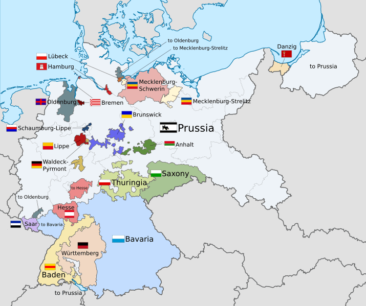
Image: Weimar Republic states map

Size of this PNG preview of this SVG file: 715 × 599 pixels. Other resolution: 286 × 240 pixels.
Original image (SVG file, nominally 976 × 818 pixels, file size: 981 KB)
Description: A map of the states of the Weimar Republic, showing their location, flags and names in English.
Author: File:Weimar Republic blank map.svg: Shadowxfox / **derivative work Alphathon /'æɫfə.θɒn/
Usage Terms: Creative Commons Attribution-Share Alike 3.0
License: CC-BY-SA-3.0
License Link: http://creativecommons.org/licenses/by-sa/3.0/
Attribution Required?: Yes
Image usage
There are no pages that link to this image.

All content from Kiddle encyclopedia articles (including the article images and facts) can be freely used under Attribution-ShareAlike license, unless stated otherwise.