
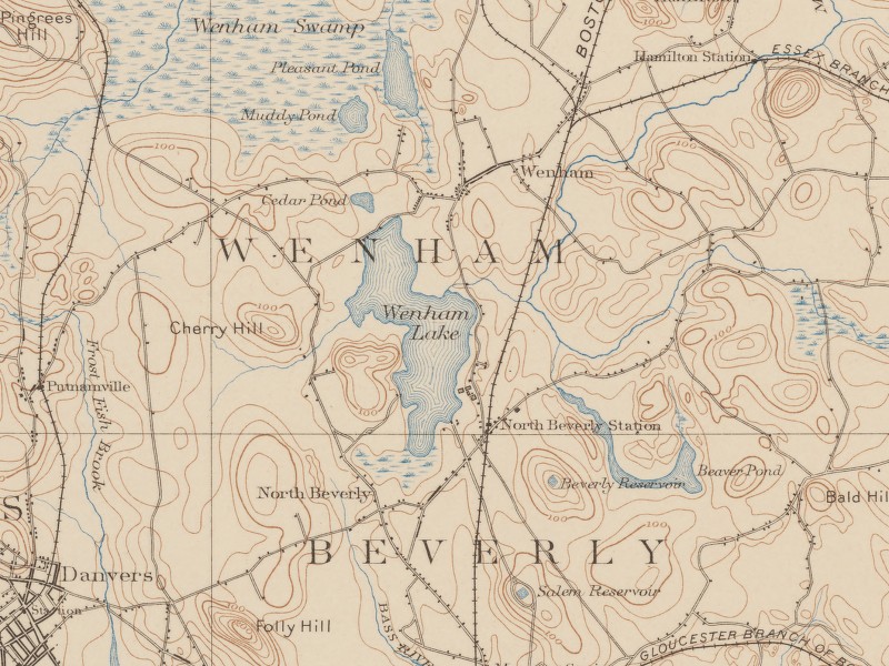
Image: Wenham Lake - USGS Map (December 1897)
No higher resolution available.
Wenham_Lake_-_USGS_Map_(December_1897).jpg (800 × 600 pixels, file size: 182 KB, MIME type: image/jpeg)
Description: Wenham Lake, Wenham, Massachusetts, USA. USGS map from 1897 showing development at that time, including railroads for transporting Wenham ice.
Title: Wenham Lake - USGS Map (December 1897)
Credit: United States Geological Survey (USGS) map, dated December 1897.
Author: United States Geological Survey (USGS).
Permission: Original work of the US Federal Government - public domain
Usage Terms: Public domain
License: Public domain
Attribution Required?: No
Image usage
The following page links to this image:

All content from Kiddle encyclopedia articles (including the article images and facts) can be freely used under Attribution-ShareAlike license, unless stated otherwise.
.jpg)