
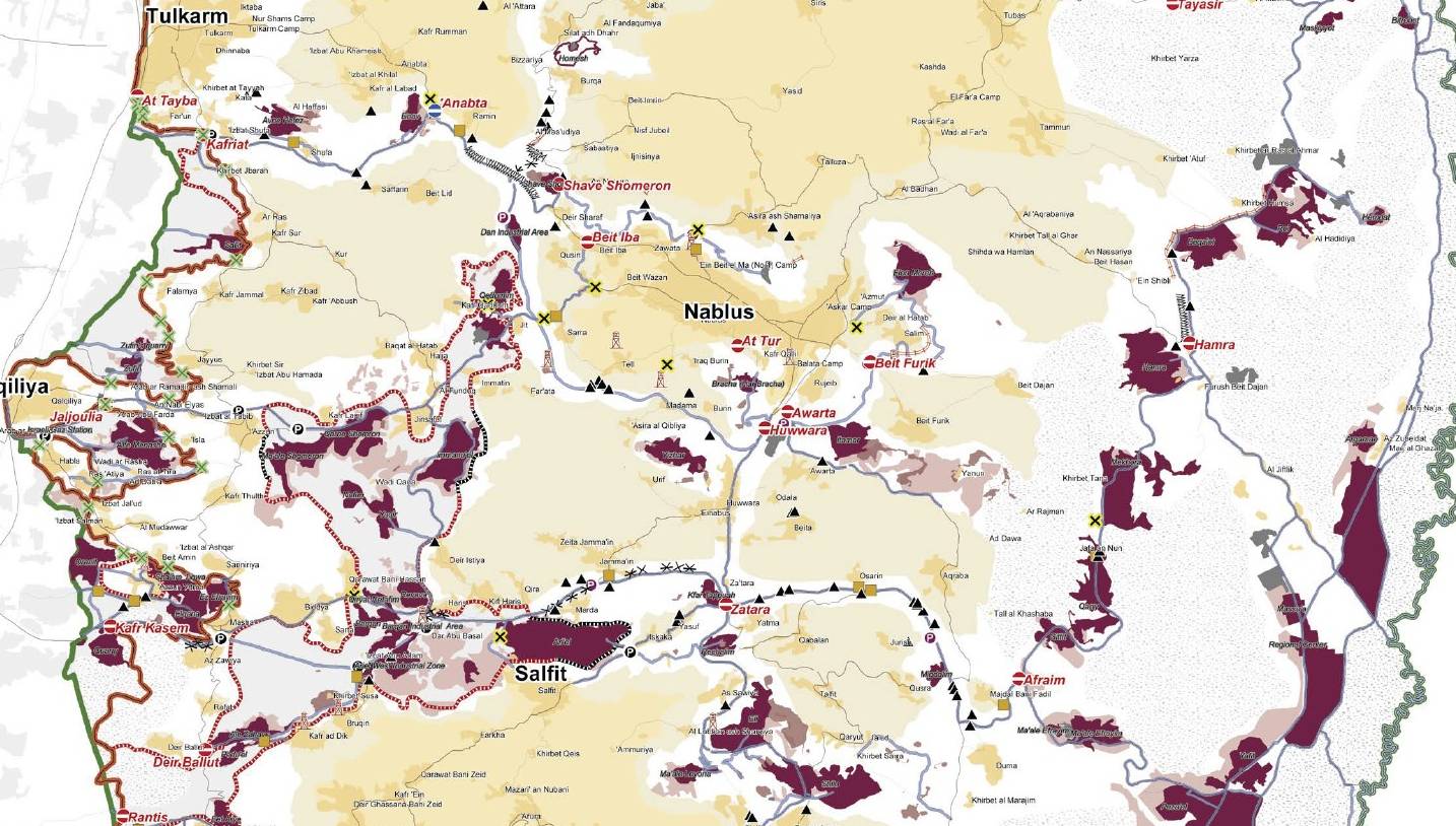
Image: Westbankjan06-samaria
Size of this preview: 800 × 454 pixels. Other resolutions: 320 × 182 pixels | 1,434 × 814 pixels.
Original image (1,434 × 814 pixels, file size: 210 KB, MIME type: image/jpeg)
Description: Piece of File:Westbankjan06.jpg which is a detailed map of Israeli settlements on the West Bank, January 2006. Produced by the United Nations Office for the Coordination of Humanitarian Affairs - public UN source. Map Centre:
Title: Westbankjan06-samaria
Credit: Transferred from en.wikipedia to Commons by Drilnoth using CommonsHelper. See: Commons:PDF to image files
Author: United Nations
Usage Terms: Public domain
License: Public domain
Attribution Required?: No
Image usage
The following page links to this image:

All content from Kiddle encyclopedia articles (including the article images and facts) can be freely used under Attribution-ShareAlike license, unless stated otherwise.