
Image: Western-mediterranean-rome-hadrian
No higher resolution available.
Western-mediterranean-rome-hadrian.jpg (800 × 600 pixels, file size: 437 KB, MIME type: image/jpeg)
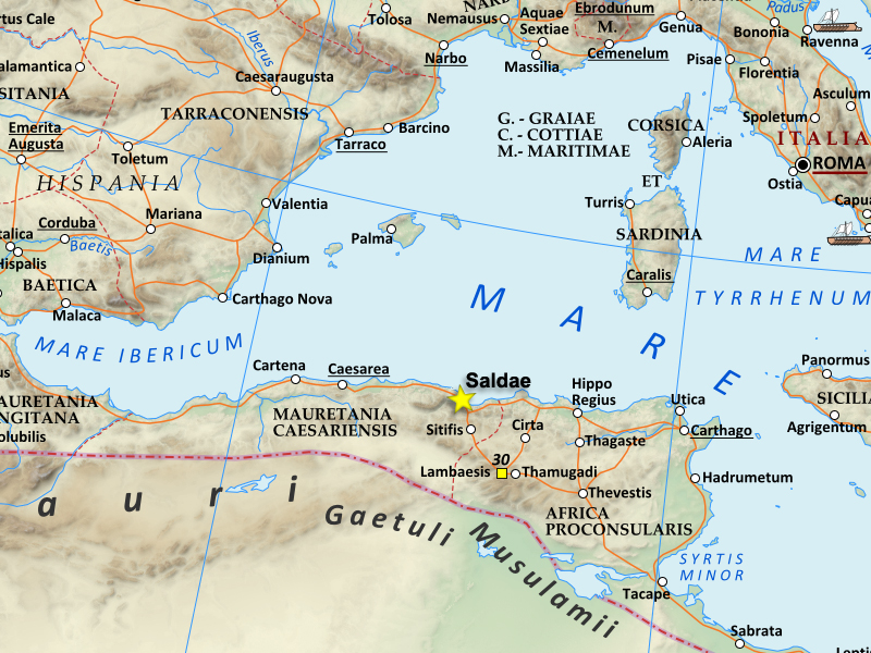
Description: This is a map of the Western Roman empire around the Mediterranean, around the time of Hadrian in the 2nd century AD. It specifically shows Saldae, at this time an important port city, and later the capital of the Vandal Kingdom.
Title: Western-mediterranean-rome-hadrian
Credit: This is based on an existing Wikipedia image, which I cropped and altered to emphasize Saldae. I'm uploading my image under the same CCA-SA3+CFDL license the original file had
Author: Kazvorpal
Usage Terms: Creative Commons Attribution-Share Alike 3.0
License: CC BY-SA 3.0
License Link: https://creativecommons.org/licenses/by-sa/3.0
Attribution Required?: Yes
Image usage
The following page links to this image:

All content from Kiddle encyclopedia articles (including the article images and facts) can be freely used under Attribution-ShareAlike license, unless stated otherwise.