
Image: Western sahara walls moroccan
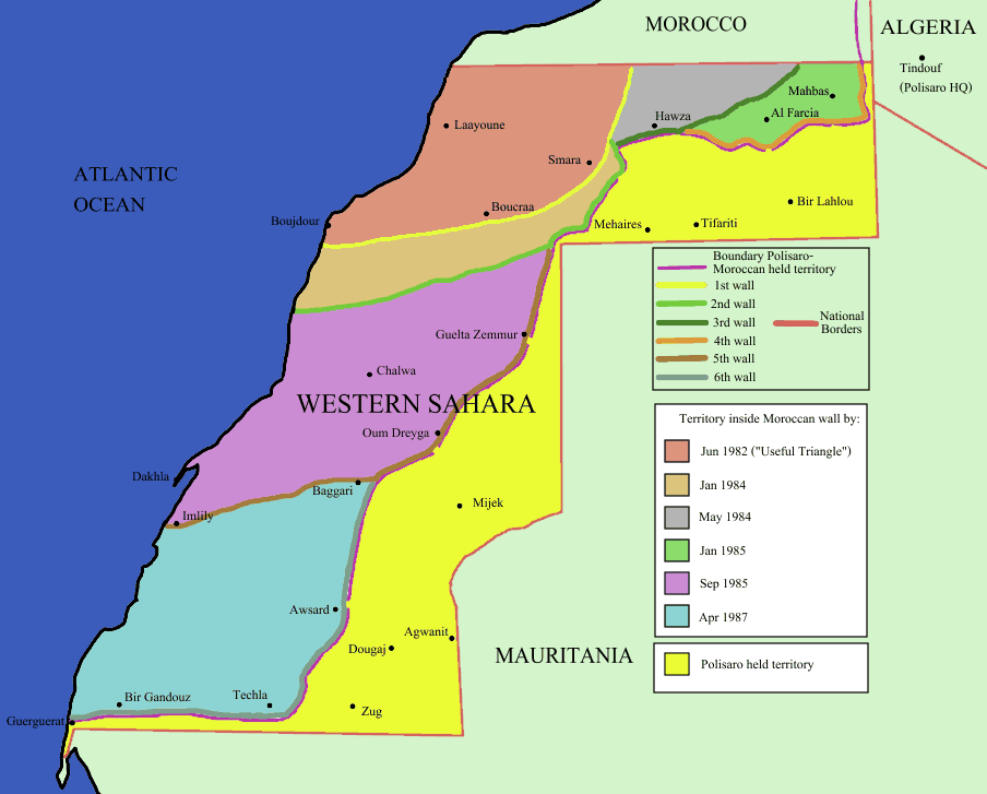
Description: Map of the w:Moroccan Defensive Wall in w:Sahara - built over several stages during war against backed Algerian and Libya militias POLISARIO , shows the six Defensive walls built, & when the territory was behind Moroccan defensive wall. Also shows polisaro held territory who are based in Algeria (seen at top right). the map using UN old map map prior to ceasefire , polisario do not hold any territory within Moroccan borders , they are hosted in tindouf camps on Algerian territory [1] and this map [www.marrakech-expedition-4x4.com/images/map.jpg] for prior to ceasefire reference.
Title: Western sahara walls moroccan
Credit: Identical PNG copy of [www.marrakech-expedition-4x4.com/images/map.jpg]
Author: User:Roke
Usage Terms: Creative Commons Attribution-Share Alike 3.0
License: CC-BY-SA-3.0
License Link: http://creativecommons.org/licenses/by-sa/3.0/
Attribution Required?: Yes
Image usage
There are no pages that link to this image.
