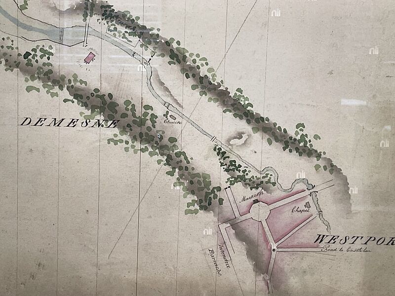
Image: Westport c1790

Description: This early map of Westport, around 1790 was prepared by the Dublin firm of Brownrigg, Longfield and Murray. It shows the formal Street layout of the early town. At the time of the map, the malls had not yet been laid out and the road to Castlebar went via Mill Street, not James Street. The only buildings identified are the market house on the Octagon, and the Catholic chapel built near the river in a similar location to the Catholic church of Saint Mary’s today. Westport house, and the old Church of Ireland Church in the grounds of the Demesne are also shown.
Title: Westport c1790
Credit: National Library of Ireland website.
Author: Brownrigg, Longfield and Murray
Usage Terms: Public domain
License: Public domain
Attribution Required?: No
Image usage
The following page links to this image:

