
Image: Wetherby town centre map 1824
Size of this preview: 636 × 600 pixels. Other resolutions: 255 × 240 pixels | 910 × 858 pixels.
Original image (910 × 858 pixels, file size: 127 KB, MIME type: image/jpeg)
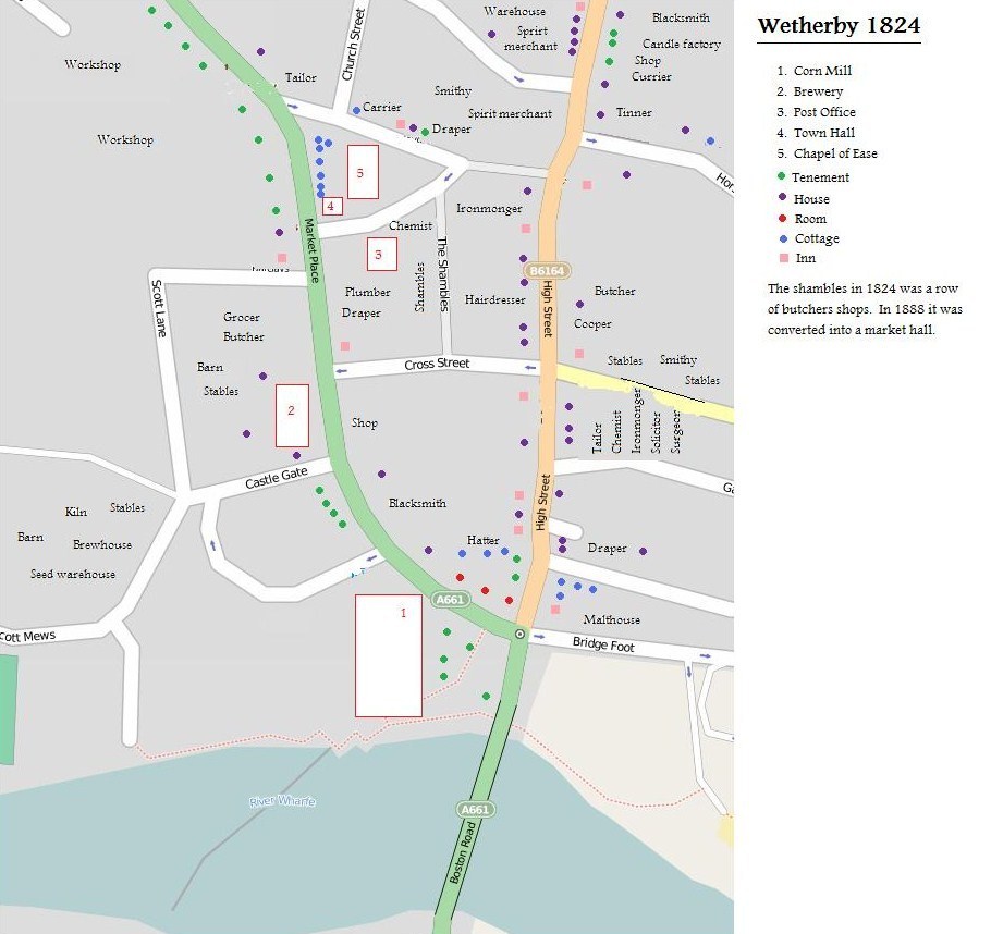
Description: Wetherby Town Centre. Inset over it are the locations of residences, businesses and landmarks as it was in 1824 the year of the great sale of Wetherby. Source for this information is ISBN 0 9511968 0 4 page 85. Locations marked as an inn include public houses. Map taken from Open Street Map (http://www.openstreetmap.org/) on Thursday 4th July 2013.
Title: Wetherby town centre map 1824
Credit: http://www.openstreetmap.org/
Author: Open Street Map and Michael Taylor (commons user Mtaylor848)
Usage Terms: Creative Commons Attribution-Share Alike 2.0
License: CC BY-SA 2.0
License Link: https://creativecommons.org/licenses/by-sa/2.0
Attribution Required?: Yes
Image usage
The following page links to this image:

All content from Kiddle encyclopedia articles (including the article images and facts) can be freely used under Attribution-ShareAlike license, unless stated otherwise.