
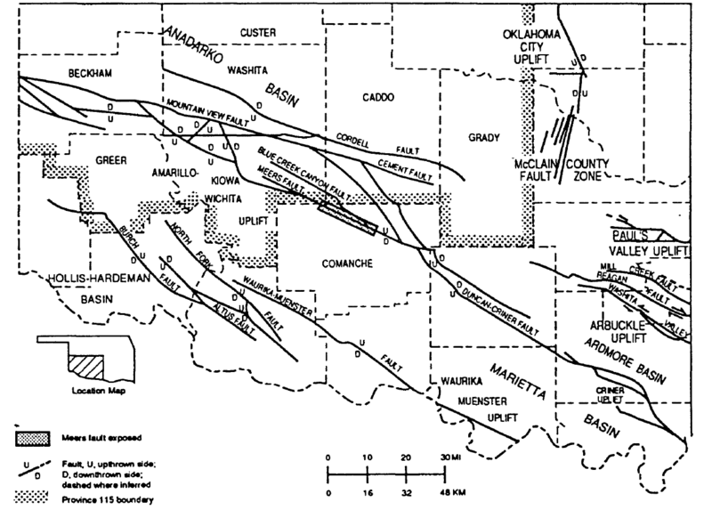
Image: Wichita Uplift fault map

Size of this preview: 800 × 573 pixels. Other resolutions: 320 × 229 pixels | 1,259 × 902 pixels.
Original image (1,259 × 902 pixels, file size: 105 KB, MIME type: image/png)
Description: Wichita Uplift fault map
Title: Wichita Uplift fault map
Credit: Petroleum Geology of the Anadarko Basin Region, Province (115), Kansas, Oklahoma, Texas, United States Geological Survey Open File Report 88-450W, US Dept. of the Interior (https://pubs.usgs.gov/of/1988/0450w/report.pdf)
Author: Mahlon Ball, Mitchell Henry, and Sherwood Frezon
Permission: https://www.usgs.gov/information-policies-and-instructions/copyrights-and-credits#copyright
Usage Terms: Public domain
License: Public domain
Attribution Required?: No
Image usage
The following page links to this image:

All content from Kiddle encyclopedia articles (including the article images and facts) can be freely used under Attribution-ShareAlike license, unless stated otherwise.