
Image: Windmill at Ballymackney, Co. Monaghan - geograph.org.uk - 718208
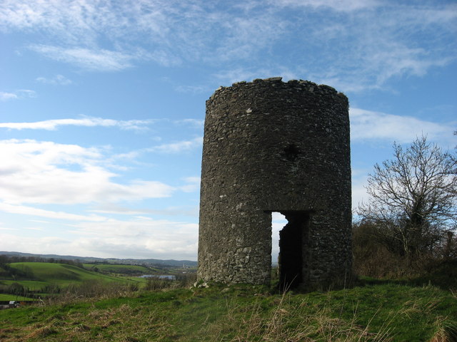
Description: Windmill at Ballymackney, Co. Monaghan Shown as a tower without sails on Taylor and Skinner's 1778 map of County Louth. Still indicated by the windmill symbol on the OS half-inch sheet 8 as late as 1967 but omitted on the 1978 edition. Hill is shown as Windmill Hill on the 1:50,000 Discovery Series sheet 35. Windmill is in the townland of Aghafad, on a hill above the hamlet of Ballymackney. Situated yards from the boundary with Co. Louth represented by the hedge to right of tower. View looks west to Monalty Lough with the town of Carrickmacross beyond.
Title: Windmill at Ballymackney, Co. Monaghan - geograph.org.uk - 718208
Credit: From geograph.org.uk
Author: Kieran Campbell
Usage Terms: Creative Commons Attribution-Share Alike 2.0
License: CC BY-SA 2.0
License Link: https://creativecommons.org/licenses/by-sa/2.0
Attribution Required?: Yes
Image usage
The following page links to this image:
