
Image: Windmill at Pepperstown, Co. Louth - geograph.org.uk - 1064760
No higher resolution available.
Windmill_at_Pepperstown,_Co._Louth_-_geograph.org.uk_-_1064760.jpg (640 × 480 pixels, file size: 115 KB, MIME type: image/jpeg)
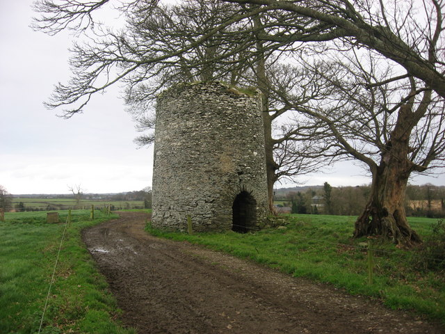
Description: Windmill at Pepperstown, Co. Louth Shown with sails on Taylor and Skinner's map of County Louth 1778 and as 'Windmill Stump' on O.S. 1st edition six-inch map surveyed 1835.
Title: Windmill at Pepperstown, Co. Louth - geograph.org.uk - 1064760
Credit: From geograph.org.uk
Author: Kieran Campbell
Usage Terms: Creative Commons Attribution-Share Alike 2.0
License: CC BY-SA 2.0
License Link: https://creativecommons.org/licenses/by-sa/2.0
Attribution Required?: Yes
Image usage
The following page links to this image:

All content from Kiddle encyclopedia articles (including the article images and facts) can be freely used under Attribution-ShareAlike license, unless stated otherwise.