
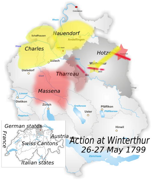
Image: Winterthur Battle 1799

Size of this PNG preview of this SVG file: 506 × 599 pixels. Other resolution: 203 × 240 pixels.
Original image (SVG file, nominally 845 × 1,001 pixels, file size: 426 KB)
Description: District of Winterthur Map drawn by Tschubby
Title: Winterthur Battle 1799
Credit: Own work using: File:Karte_Bezirk_Winterthur.png Based on Antoine Henri Jomini, baron de. Mountain warfare illustrated by the campaign of 1799 in Switzerland: being a translation of the Swiss narrative, compiled from the works of the Archduke Charles, Jomini, and other...London: Henry S. King, 1875. p. 108–109.
Author: Karte_Bezirk_Winterthur.png: Tschubby derivative work: Auntieruth55 (talk)
Usage Terms: Creative Commons Attribution-Share Alike 3.0
License: CC BY-SA 3.0
License Link: http://creativecommons.org/licenses/by-sa/3.0/
Attribution Required?: Yes
Image usage
The following page links to this image:

All content from Kiddle encyclopedia articles (including the article images and facts) can be freely used under Attribution-ShareAlike license, unless stated otherwise.