
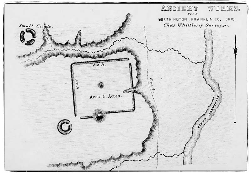
Image: Worthington Earthworks map (Charles Whittlesey, 1848) 2
No higher resolution available.
Worthington_Earthworks_map_(Charles_Whittlesey,_1848)_2.jpg (800 × 559 pixels, file size: 102 KB, MIME type: image/jpeg)
Description: A map of the Worthington Earthworks in Worthington, Ohio. Drawn by surveyor Charles Whittlesey by Ancient Monuments of the Mississippi, 1948.
Title: Worthington Earthworks map (Charles Whittlesey, 1848) 2
Credit: Touring Ohio
Author: Charles Whittlesey
Usage Terms: Public domain
License: Public domain
Attribution Required?: No
Image usage
The following page links to this image:

All content from Kiddle encyclopedia articles (including the article images and facts) can be freely used under Attribution-ShareAlike license, unless stated otherwise.
_2.jpg)