
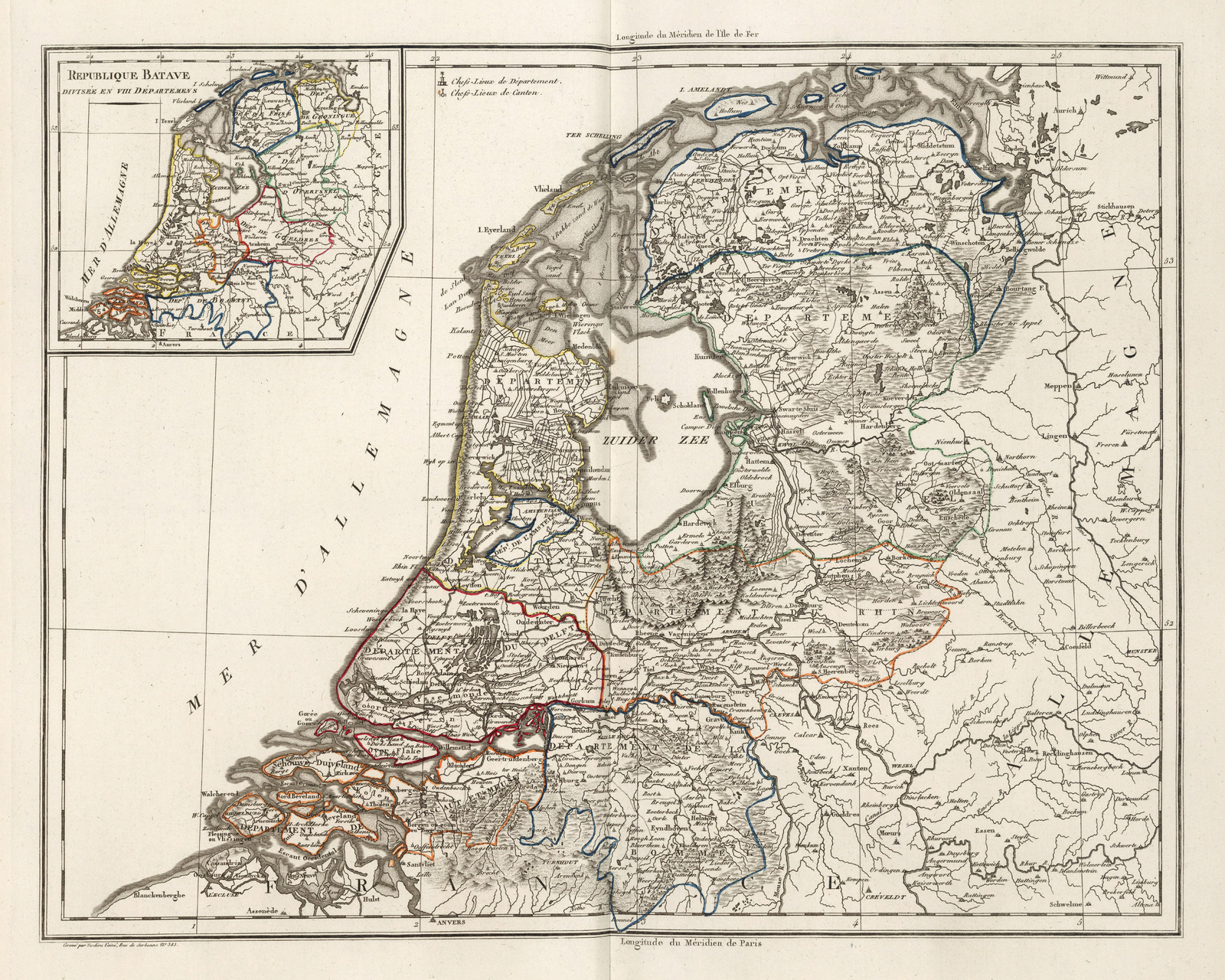
Image: XII Republique Batave carte (Bataafse Republiek) 1804 Malte-Brun
Description: French map of the Batavian Republic. The large map shows the divisions of the departments in 1799 - 1802. The small map in in the top left shows the departments in 1802 - 1806. These were the departments in 1799 - 1802: Departement de le Ems (Departement van de Eems), Departement du V. Yssel (Dep. van de Oude IJssel), Departement du Rhin (Dep. van de Rijn), Departement de Escaut et Meuse (Dep. van de Schelde en Maas), Departement du Texel (Dep. van Tessel), Departement de L'Amstel (Dep. van de Amstel), Departement du Delft (Dep. van de Delft), Departement de la Bommel (Dep. van de Dommel).
Title: XII Republique Batave carte (Bataafse Republiek) 1804 Malte-Brun
Credit: David Rumsey Map Collection - https://www.davidrumsey.com/luna/servlet/detail/RUMSEY~8~1~289903~90068511:XII--Republique-Batave-?sort=pub_list_no_initialsort%2Cpub_date%2Cpub_list_no%2Cseries_no#
Author: Edme Mentelle (1730-1815), Conrad Malte-Brun (1775-1826), Jean-Baptiste Poirson (1761-1831)
Usage Terms: Public domain
License: Public domain
Attribution Required?: No
Image usage
The following page links to this image:

_1804_Malte-Brun.jpg)