
Image: Yakushima Relief Map, SRTM

Size of this preview: 800 × 600 pixels. Other resolutions: 320 × 240 pixels | 1,600 × 1,200 pixels.
Original image (1,600 × 1,200 pixels, file size: 864 KB, MIME type: image/jpeg)
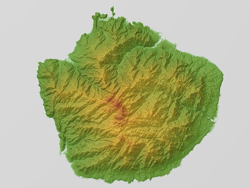
Description: Relief map of Yakushima, Kagoshima prefecture, Japan. From "SRTM-1 (30m Mesh) Ver.3 2014".
Title: Yakushima Relief Map, SRTM
Credit: NASA's Shuttle Radar Topography Mission (SRTM-1 "30m Mesh")
Author: Batholith (Wikimedia Commons) Batholith (Wikipedia)
Permission: I, the copyright holder of this work, release this work into the public domain. This applies worldwide. In some countries this may not be legally possible; if so: I grant anyone the right to use this work for any purpose, without any conditions, unless such conditions are required by law.
Usage Terms: Public domain
License: Public domain
Attribution Required?: No
Image usage
The following page links to this image:

All content from Kiddle encyclopedia articles (including the article images and facts) can be freely used under Attribution-ShareAlike license, unless stated otherwise.