
Image: YamaseeWarMap01
Size of this preview: 800 × 553 pixels. Other resolutions: 320 × 221 pixels | 1,008 × 697 pixels.
Original image (1,008 × 697 pixels, file size: 131 KB, MIME type: image/png)
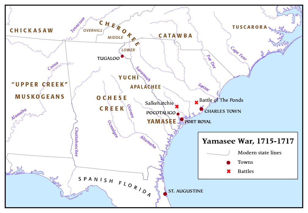
Description: This is an overview map of Yamasee War that I, Pfly, made.
Title: YamaseeWarMap01
Credit: self-made. Sources consulted include: Gallay, Alan (2002) The Indian Slave Trade: The Rise of the English Empire in the American South 1670-1717, Yale University Press ISBN: 0-300-10193-7. Oatis, Steven J. (2004) A Colonial Complex: South Carolina's Frontiers in the Era of the Yamasee War, 1680-1730, University of Nebraska Press ISBN: 0-8032-3575-5.
Author: Pfly
Usage Terms: Creative Commons Attribution-Share Alike 3.0
License: CC-BY-SA-3.0
License Link: http://creativecommons.org/licenses/by-sa/3.0/
Attribution Required?: Yes
Image usage
The following 2 pages link to this image:

All content from Kiddle encyclopedia articles (including the article images and facts) can be freely used under Attribution-ShareAlike license, unless stated otherwise.