
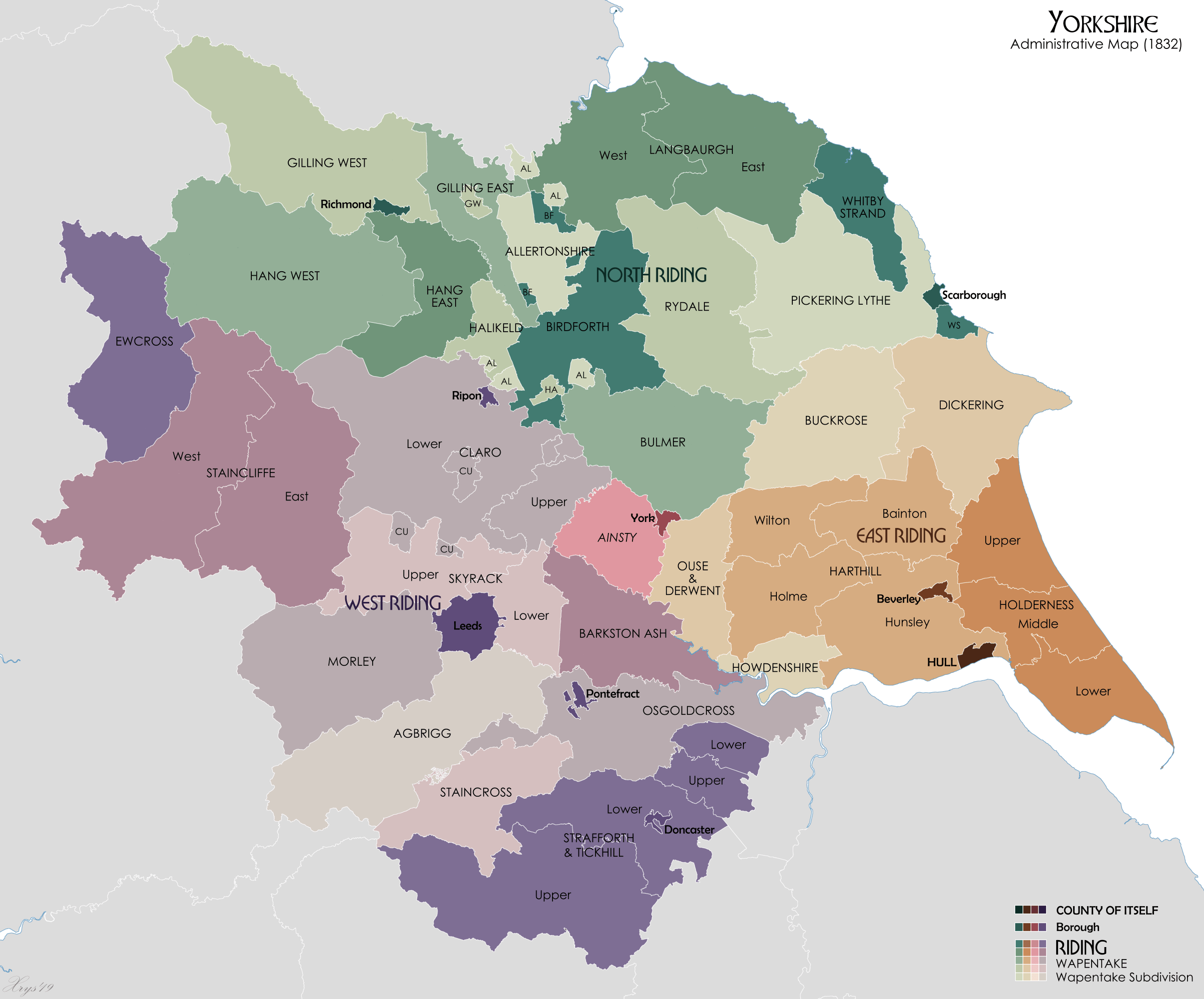
Image: Yorkshire Administrative Map 1832
Size of this preview: 723 × 600 pixels. Other resolutions: 289 × 240 pixels | 2,410 × 2,000 pixels.
Original image (2,410 × 2,000 pixels, file size: 226 KB, MIME type: image/png)
Description: Administrative map of Yorkshire in 1832 showing Ridings and Wapentakes. Also showing extant Boroughs and the County of Itself of Hull. Wapentake boundaries from University of Nottingham English Place Name Society. Source data for parish boundaries - Kain, R.J.P., and Oliver, R.R. (2001) "Historic parishes of England and Wales". Unit names from Vision of Britain website.
Title: Yorkshire Administrative Map 1832
Credit: Own work
Author: XrysD
Usage Terms: Creative Commons Attribution-Share Alike 3.0
License: CC BY-SA 3.0
License Link: https://creativecommons.org/licenses/by-sa/3.0
Attribution Required?: Yes
Image usage
The following page links to this image:

All content from Kiddle encyclopedia articles (including the article images and facts) can be freely used under Attribution-ShareAlike license, unless stated otherwise.