Image: Zapatacuba-map
Zapatacuba-map.png (634 × 323 pixels, file size: 16 KB, MIME type: image/png)
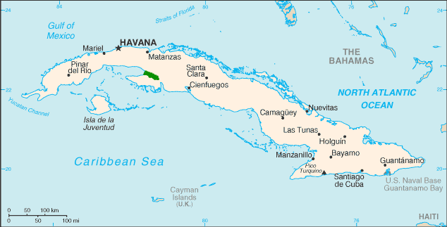
Description: Range map of Zapata Rail Source data from Raffaele, Herbert A; Wiley, James; Garrido, Orlando H; Keith, Allan R; Raffaele, Janis I (2003) Field Guide to the Birds of the West Indies, Christopher Helm, pp. 58 ISBN: 0713654198. and Zapata Rail – BirdLife Species Factsheet. BirdLife International. Mapped on CIA map
Title: Zapatacuba-map
Credit: Own work
Author: Jimfbleak
Usage Terms: Public domain
License: Public domain
Attribution Required?: No
Image usage
The following page links to this image:

All content from Kiddle encyclopedia articles (including the article images and facts) can be freely used under Attribution-ShareAlike license, unless stated otherwise.

