
Image: Zone-de-controle-M23

Size of this PNG preview of this SVG file: 457 × 599 pixels. Other resolution: 183 × 240 pixels.
Original image (SVG file, nominally 512 × 671 pixels, file size: 399 KB)
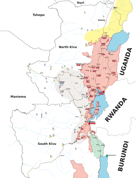
Description: Map of areas under the control of the M23 and its allies in Kivu. Legend: Armed Groups:
Areas under the control of the M23 and its allies (Rwandan army) Presence of the Ugandan armed forces Presence of the Burundian armed forces Presence of armed militias allied with the government (Wazalendo) Areas controlled by the FARDC government Resources: Gold mines
3T mines (tin, tungsten, and tantalum)
Usage Terms: Public domain
Image usage
The following page links to this image:

All content from Kiddle encyclopedia articles (including the article images and facts) can be freely used under Attribution-ShareAlike license, unless stated otherwise.