National Register of Historic Places listings in western Puerto Rico facts for kids
Have you ever wondered about old buildings and places that hold important stories from the past? In western Puerto Rico, there are many such places! They are listed on something called the National Register of Historic Places. This is a special list in the United States that helps protect buildings, sites, and objects that are important to history.
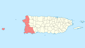
This article will tell you about some of these amazing historic places. They are found in 12 towns (municipalities) in western Puerto Rico. These towns include Moca, Aguadilla, Aguada, Rincón, Añasco, Mayagüez, Hormigueros, San Germán, Sábana Grande, Guánica, Lajas, and Cabo Rojo.
Contents
- What is the National Register of Historic Places?
- Historic Places in Aguada
- Historic Places in Aguadilla
- Historic Places in Añasco
- Historic Places in Cabo Rojo
- Historic Places in Guánica
- Historic Places in Hormigueros
- Historic Places in Lajas
- Historic Places in Mayagüez
- Asilo De Pobres
- Casa Consistorial De Mayaguez
- Cementerio Municipal de Mayagüez
- Duran Esmoris Residencia
- Edificio Jose de Diego
- Faro de la Isla de la Mona
- Gomez Residencia
- Isla de Mona
- Logia Adelphia
- Nazario Rivera Residencia
- Plaza Publica
- Puente de Añasco
- Ramírez Fuentes Residencia
- Teatro Yaguez
- U.S. Custom House
- U.S. Post Office and Courthouse
- Historic Places in Moca
- Historic Places in Rincón
- Historic Places in Sabana Grande
- Historic Places in San Germán
What is the National Register of Historic Places?
The National Register of Historic Places is like a hall of fame for important historical sites. It's managed by the United States government. When a place is added to this list, it means it's recognized for its history, architecture, or culture. This helps protect these places for future generations to enjoy and learn from.
Historic Places in Aguada
Aguada is a town on the western coast of Puerto Rico. It has one special place on the National Register.
Puente de Coloso
The Puente de Coloso is a historic bridge. It's located on Highway 418. This bridge is part of a group of historic bridges in Puerto Rico that are recognized for their importance. It was added to the list in 2010.
Historic Places in Aguadilla
Aguadilla is a lively coastal town. It has several interesting historic places.
Cardona Residence
The Cardona Residence is an old house at 55 Ramón E. Betances Street. It was listed in 1985.
Casa de Piedra
The Casa de Piedra (which means "Stone House") is another historic home. It's also known as the Amparo Roldán House. This Spanish colonial house is at 14 Progreso Street and was added to the list in 1986.
Church San Carlos Borromeo of Aguadilla
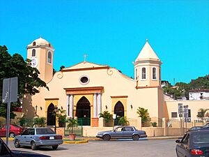
The Church San Carlos Borromeo of Aguadilla is a beautiful church in the town plaza. It's on José de Diego Street. This church has been a central part of Aguadilla for many years and was listed in 1984.
District Courthouse
The District Courthouse on Progreso Street is another important building. It was added to the National Register in 1985.
Faro de Punta Borinquen
The Faro de Punta Borinquen is a lighthouse located off Highway 107. Lighthouses are very important for guiding ships. This one was listed in 1981.
Fuerte de la Concepción
The Fuerte de la Concepción is an old fort on Agustín Stahl Street. Forts were built to protect towns. This one was recognized in 1986.
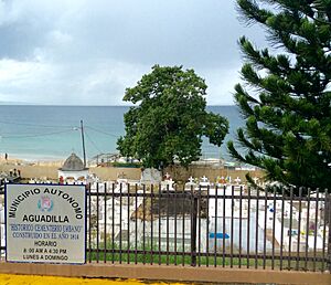
Old Urban Cemetery
The Old Urban Cemetery is a historic cemetery at the foot of Cuesta Vieja. It was listed in 1985.
El Parterre – Ojo De Agua
El Parterre – Ojo De Agua is a historic area bounded by several streets. It was added to the list in 1986.
Residence Lopez
The Residence Lopez at 67 Progreso Street is a significant house. Built in 1914, it shows how wealthy Puerto Rican families lived in the early 20th century. It was designed by a famous architect, Manuel Gómez Tejera. It was listed in 1985.
Historic Places in Añasco
Añasco is a town known for its beautiful landscapes. It has two places on the National Register.
Hostos–Ramírez de Arellano School District
The Hostos–Ramírez de Arellano School District is a historic area that includes schools. It's located at Calle San Antonio and Calle 65th de Infantería. This district was added to the list in 2017.
Puente de Añasco
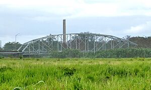
The Puente de Añasco is a bridge on Highway 2. It connects Añasco with Mayagüez. This bridge was listed in 2011.
Historic Places in Cabo Rojo
Cabo Rojo is famous for its stunning beaches and a beautiful lighthouse.
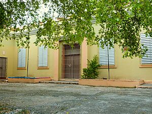
James L. M. Curry Graded School
The James L. M. Curry Graded School is a historic school building on Calle Betances. It was listed in 2019.
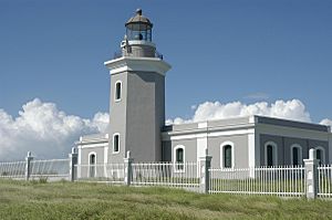
Faro de los Morrillos de Cabo Rojo
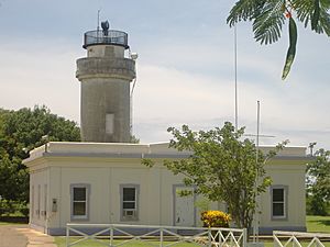
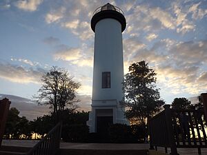
The Faro de los Morrillos de Cabo Rojo is a very famous lighthouse. It stands proudly south of Pole Ojea. This lighthouse helps guide ships and offers amazing views. It was added to the National Register in 1981.
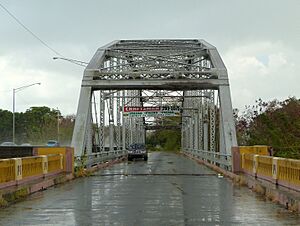
Silva Bridge
The Silva Bridge is a historic bridge on Highway 114. It's a "Pratt pony truss bridge" built in 1897. This type of bridge has a special design. It was listed in 1995.
Historic Places in Guánica
Guánica is a town with a rich history, especially related to the Spanish-American War.
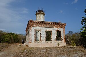
Faro de Guanica
The Faro de Guanica is a ruined lighthouse on Highway 333. It was built by Spanish authorities in 1893. It marked the entrance to Guánica Bay, an important harbor. This lighthouse was listed in 1977.
James Garfield Graded School
The James Garfield Graded School is a historic school building on 65 de Infantería Street. It was listed in 2015.
Hacienda Santa Rita
The Hacienda Santa Rita is a historic estate on Highway 116R. Haciendas were large farms or plantations. This one was listed in 1984.
Yauco Battle Site
The Yauco Battle Site is where the Battle of Yauco happened in 1898 during the Spanish–American War. This battle was an important event in Puerto Rico's history. Even though it's called "Yauco," the site is now part of modern-day Guánica. It was listed in 2008.
Historic Places in Hormigueros
Hormigueros is a small town known for its religious sanctuary.
Casa Márquez
The Casa Márquez is a historic house at 8 Segundo Ruiz Belvis Street. It was listed in 2015.
Santuario de la Monserrate de Hormigueros and Casa de Peregrinos
The Santuario de la Monserrate de Hormigueros and Casa de Peregrinos is a famous church and pilgrim's house. It's on 1 Peregrinos Street. This church is a very important religious site in Puerto Rico. It was listed in 1975.
Silva Bridge
The Silva Bridge is also partly in Hormigueros, connecting it with Cabo Rojo. It's a Pratt pony truss bridge from 1897. It was listed in 1995.
Torrens Bridge
The Torrens Bridge on Highway 319 is a unique bridge built in 1878. It has a special design that is rare in the United States. This bridge was even captured by the U.S. Army in 1898 during the Spanish-American War. It was listed in 2000.
Historic Places in Lajas
Lajas is a town in the southwest of Puerto Rico.
Luis Muñoz Rivera School
The Luis Muñoz Rivera School is a historic school building at the junction of 65 de Infantería and M. Dávila Streets. It was listed in 2012.
Oliver Hazard Perry Graded School
The Oliver Hazard Perry Graded School is another historic school. It's at the junction of San Blas and Concordia Streets. It was listed in 2016.
Historic Places in Mayagüez
Mayagüez is one of the largest cities in western Puerto Rico. It has many significant historic sites.
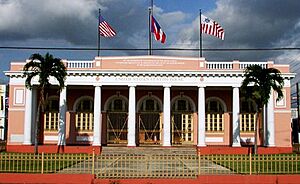
Asilo De Pobres
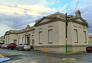
The Asilo De Pobres (Poor Asylum) on Post Street is a building from 1920. It's built in a style called Classical Revival. It was listed in 1985.
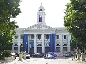
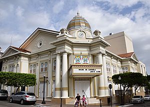
Casa Consistorial De Mayaguez
The Casa Consistorial De Mayaguez is the city hall, built in 1926. It's on Peral Street. This important building was listed in 1985.
Cementerio Municipal de Mayagüez
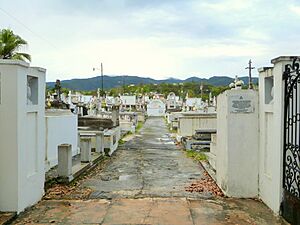
The Cementerio Municipal de Mayagüez is the municipal cemetery. It's at the southern end of Post Street and was listed in 1988.
Duran Esmoris Residencia
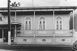
The Duran Esmoris Residencia on Méndez Vigo Street is a bungalow or Craftsman-style building from 1921. It was designed by Luis Fernando Nieva and listed in 1988.
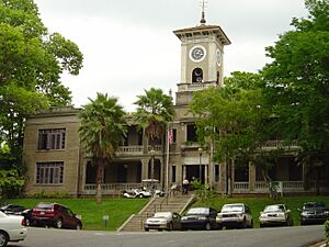
Edificio Jose de Diego
The Edificio Jose de Diego is the central administration building of the University of Puerto Rico at Mayagüez. It was built in 1913 and listed in 1977.
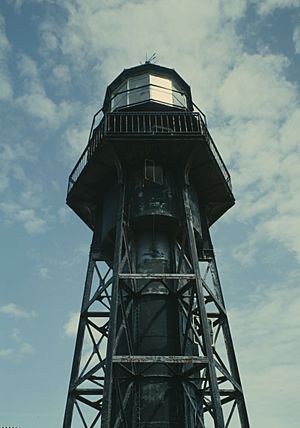
Faro de la Isla de la Mona
The Faro de la Isla de la Mona is a lighthouse on the east side of Mona Island. Mona Island is a special nature reserve. This lighthouse was listed in 1981.
Gomez Residencia
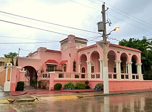
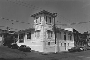
The Gomez Residencia at 60 Méndez Vigo Street is a building from 1933. It was designed by architect Francisco Porrata Doria and listed in 1988.
Isla de Mona
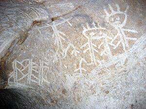
Isla de Mona itself is recognized as a historic district. This island is known for its natural beauty and historical importance. It was listed in 1993.
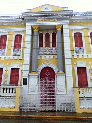
Logia Adelphia
The Logia Adelphia at 64E Sol Street is a building from 1912. It was designed by Sabas Honore and listed in 1986.
Nazario Rivera Residencia
The Nazario Rivera Residencia at 105 Post Street was built in 1872. It was designed by Juaquín Hernández and listed in 1988.
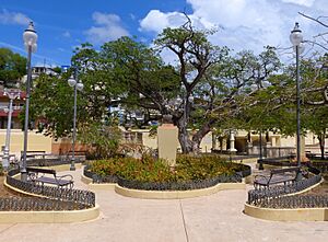
Plaza Publica
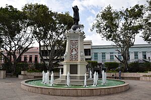
The Plaza Publica (Public Plaza) on Candelaria Street is a historic town square dating back to 1760. Town plazas are often the heart of a community. It was listed in 1985.
Puente de Añasco
The Puente de Añasco is also partly in Mayagüez, connecting it with Añasco. It was listed in 2011.
Ramírez Fuentes Residencia
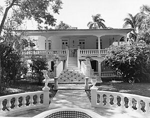
The Ramírez Fuentes Residencia at 117 Méndez Vigo Street is a bungalow/Craftsman-style building from 1925. It was designed by Pascasio Fajardo and listed in 1988.
Teatro Yaguez
The Teatro Yaguez is a historic theater at the junction of Candelaria and Basora Streets. It was built in 1909 and designed by Sabas Honore and others. It was listed in 1985.
U.S. Custom House
The U.S. Custom House is a building at the junction of Candelaria Street and José González Clemente Avenue. It was built in 1924 and designed by Rafael Carmoega. It was listed in 1988.
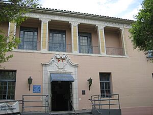
U.S. Post Office and Courthouse
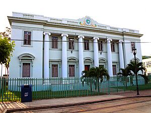
The U.S. Post Office and Courthouse is at the junction of Candelaria and Pilar DeFillo Streets. It was built in 1935 and designed by Louis A. Simpson. It was listed in 1986.
Historic Places in Moca
Moca is a town in the northern part of western Puerto Rico.
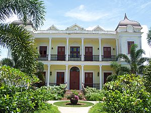
Hacienda Iruena Manor House
The Hacienda Iruena Manor House on Highway 2 is a beautiful building from 1893. It's built in a Renaissance/French Chateau style. It was listed in 1987.
Historic Places in Rincón
Rincón is a popular surfing destination. It also has some unique historic sites.
Boiling Nuclear Superheater (BONUS) Reactor Facility
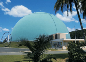
The Boiling Nuclear Superheater (BONUS) Reactor Facility is a very interesting site. It was an experimental nuclear reactor. It's located at the end of Branch 4413, Highway 413. This facility was listed in 2007.
Faro de Punta Higuero
The Faro de Punta Higuero is another lighthouse in Rincón, on Highway 413. It was listed in 1981.
Historic Places in Sabana Grande
Sabana Grande is a town in the southwest of Puerto Rico.
Cementerio Masónico de la Resp. Logia Igualdad Núm. 23 de Sabana Grande
This is a Masonic Cemetery at the junction of Highway 121 and Street 1. It was listed in 2013.
Church of San Isidro Labrador and Santa María de la Cabeza of Sabana Grande
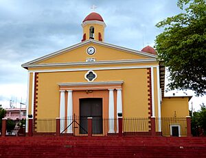
This church in the town plaza was built in 1844. It's on Ángel G. Martínez Street and was listed in 1984.
James Fenimore Cooper Graded School
The James Fenimore Cooper Graded School is a historic school building at 20 San Isidro Street. It was listed in 2015.
Hacienda San Francisco
The Hacienda San Francisco is a historic estate on Callejón de la Hacienda. It was listed in 1995.
Berta Sepulveda House
The Berta Sepulveda House at 37 Luis Muñoz Rivera Street was listed in 1994.
Historic Places in San Germán
San Germán is one of the oldest towns in Puerto Rico, full of colonial charm.
Jaime Acosta y Fores Residence
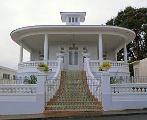
The Jaime Acosta y Fores Residence at 70 Dr. Santiago Veve Street is a "Vernacular Criollo" house built in 1917. It was listed in 1990.
Alcantarilla Pluvial sobre la Quebrada Manzanares
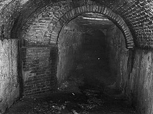
This is a historic storm drain system built in 1835. It extends from Ferrocarril and Esperanza Streets. It was listed in 1990.
Church San Germán Auxerre of San Germán
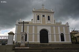
The Church San Germán Auxerre of San Germán on De la Cruz Street is a very old church, built in 1688! It was listed in 1984.
Convento de Porta Coeli
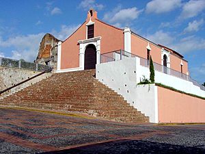
The Convento de Porta Coeli is a historic convent and church in Plaza Porta Coeli. It's one of the oldest churches in the Americas. It was listed in 1976.
Observation Tower
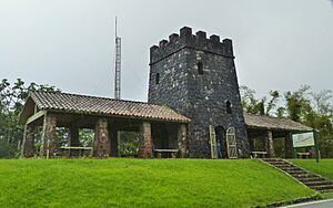
The Observation Tower in Maricao State Forest is on Highway 120. It offers great views and was listed in 2016.
San Germán Historic District
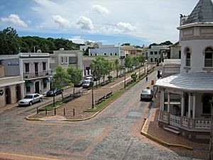
The San Germán Historic District is a large area of the town that is recognized for its historic buildings. It includes colonial and other architecture dating back to 1606. This entire district was listed in 1994.


