National Register of Historic Places listings in Prince of Wales–Hyder Census Area, Alaska facts for kids
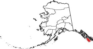
Have you ever wondered about really old and important places in Alaska? This article is all about special spots in the Prince of Wales–Hyder Census Area that are listed on the National Register of Historic Places. This is like a special list kept by the United States government to protect places that are important to history or culture.
Contents
What is the National Register of Historic Places?
The National Register of Historic Places, or NRHP, is an official list of buildings, sites, objects, structures, and districts that are important in American history, architecture, archaeology, engineering, and culture. When a place is added to this list, it means it's recognized as special and efforts are made to help preserve it for future generations. It's like giving a medal to a historic building or area!
Cool Historic Places in Prince of Wales–Hyder Census Area
There are six amazing places in this area of Alaska that have made it onto the National Register. Let's explore them!
Cape Decision Light Station
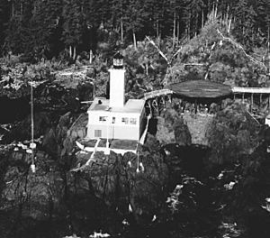
The Cape Decision Light Station is a lighthouse located on the southwestern tip of Kuiu Island. Lighthouses are super important because they help guide ships safely through the water, especially in tricky areas. This light station was added to the National Register in 2005. It stands as a beacon of safety and a reminder of maritime history in Alaska.
Chief Son-I-Hat's Whale House and Totems Historic District
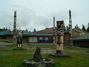
This historic district is found near Kasaan. It's a very important cultural site for the Haida people. The "Whale House" was a traditional home, and the totems are tall, carved poles that tell stories and represent the history of families and clans. These totems are incredible works of art and history. This district was recognized in 2002.
Father William Duncan House
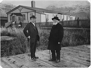
The Father William Duncan House is in Metlakatla. William Duncan was a missionary who played a big role in the history of the Tsimshian people in Alaska. His home was listed on the National Register in 1972, showing its importance to the community's past.
Hydaburg Totem Park
Located in Hydaburg, this totem park is another amazing place to see traditional Native Alaskan art and culture. Just like the totems at Kasaan, these carved poles tell important stories and represent the heritage of the Haida people. The park was added to the National Register in 2006. It's a wonderful place to learn about the rich history of the region's Indigenous communities.
Kake Cannery
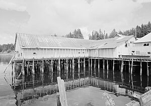
The Kake Cannery is an old fish processing plant located near Kake. Canneries were very important in Alaska's history because fishing, especially for salmon, was a huge industry. This cannery shows how people worked and lived in the past, processing fish to send all over the world. It was listed on the National Register in 1997.
Storehouse No. 4
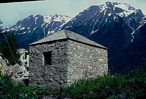
In the town of Hyder, you can find Storehouse No. 4. This building was likely used for storing goods and supplies, which was essential for towns in remote areas like Hyder, especially during times when mining and other industries were booming. It's a piece of the town's working history and was added to the National Register in 1976.
These six places offer a glimpse into the diverse and fascinating history of the Prince of Wales–Hyder Census Area, from guiding ships to preserving cultural stories and showing how people lived and worked.


