Bágala facts for kids
Quick facts for kids
Bágala
|
|
|---|---|
|
Corregimiento
|
|
| Country | |
| Province | Chiriquí |
| District | Boquerón |
| Area | |
| • Land | 42.9 km2 (16.6 sq mi) |
| Population
(2010)
|
|
| • Total | 2,330 |
| • Density | 54.3/km2 (141/sq mi) |
| Population density calculated based on land area. | |
| Time zone | UTC−5 (EST) |
| Climate | Am |
Bágala is a small area in Panama. It is part of the Boquerón District in the Chiriquí Province. A "corregimiento" is like a local administrative area or a small town.
About Bágala
Bágala covers a land area of about 42.9 square kilometers. That's about 16.6 square miles. In 2010, the population of Bágala was 2,330 people. This means there were about 54 people living in each square kilometer. This number is called the population density.
Population Changes
The number of people living in Bágala has grown over the years.
- In 1990, there were 1,653 people.
- By 2000, the population increased to 2,038 people.
- In 2010, it reached 2,330 people.
This shows that more and more people are choosing to live in Bágala.
Where is Bágala?
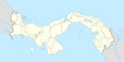
Bágala is located in the western part of Panama. It is in the Chiriquí Province, which is known for its beautiful landscapes. The area has a tropical monsoon climate. This means it usually has warm temperatures and a lot of rain during certain times of the year.
See also
 In Spanish: Bágala para niños
 | Isaac Myers |
 | D. Hamilton Jackson |
 | A. Philip Randolph |


