Baca, Yucatán facts for kids
Quick facts for kids
Baca
|
|
|---|---|
|
Locality
|
|

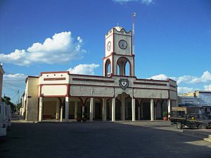
Municipal Palace of Baca, Yucatán.
|
|
| Country | |
| State | |
| Municipality | Baca Municipality |
| Area | |
| • Total | 4.723 km2 (1.824 sq mi) |
| Elevation | 10 m (30 ft) |
| Population
(2020)
|
|
| • Total | 4,997 |
| • Density | 1,058.01/km2 (2,740.2/sq mi) |
| Time zone | UTC-6 (Central Standard Time) |
| • Summer (DST) | UTC-5 (Central Daylight Time) |
| Area code(s) | 991 |
| INEGI Code | 310040001 |
| Major Airport | Merida (Manuel Crescencio Rejón) International Airport |
| IATA Code | MID |
| ICAO Code | MMMD |
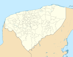
Baca is a small and interesting town in Yucatán, Mexico. It's the main town in the Baca area. You can find Baca about 32 kilometers (20 miles) east of Mérida, a big city. It's also just 8 kilometers (5 miles) west of Motul.
Contents
What Does the Name Baca Mean?
The name Baca comes from the Yucatec Maya language. It means "water in the shape of a horn." This name probably describes how water looked in the area a long time ago. Maybe it was a special spring or a unique water source!
Baca's History: From Ancient Times to Today
Baca has a long and exciting history. After the ancient city of Mayapan fell in 1441, the land where Baca is now became part of the Ceh Pech region.
Baca During the Spanish Arrival
When the Spanish arrived and took control, Baca became part of a system called encomienda. This system meant that Spanish leaders were in charge of groups of native people and their land.
The local leader, called a batab, was named Ah-Op-Pech. He was baptized and given the Spanish name Ambrosio Pech. He also became the governor of the area. Later, his son, Pedro Pech, took over as governor in 1567.
Baca Becomes an Official Town
Over many years, Baca grew and changed. On October 15, 1881, Baca was officially given the status of a town. This was an important step in its development.
How Many People Live in Baca?
The number of people living in Baca has changed over time. This is called demographics, which is the study of populations. The chart below shows how the population has grown and shrunk in different years.
Fun Festivals in Baca
Baca celebrates a few special events each year. These festivals are a great way for the community to come together and have fun.
- Every year from May 1st to May 3rd, Baca holds a big party to honor the Holy Cross.
- Also in May, from the 15th to the 19th, there is an annual festival for San Isidro Labrador.
See also
 Want to learn more? Check out the Spanish version for kids: Baca (Yucatán) para niños
 | Calvin Brent |
 | Walter T. Bailey |
 | Martha Cassell Thompson |
 | Alberta Jeannette Cassell |


