Banteay Meanchey Province facts for kids
Quick facts for kids
Banteay Meanchey Province
ខេត្តបន្ទាយមានជ័យ
|
|
|---|---|

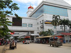
Street in Poipet
|
|

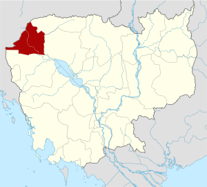
Map of Cambodia highlighting Banteay Meanchey
|
|
| Country | |
| Provincial status | 1993 |
| Capital | Serei Saophoan Municipality |
| Area | |
| • Total | 6,679 km2 (2,579 sq mi) |
| Population
(2019 census)
|
|
| • Total | |
| • Density | 129/km2 (330/sq mi) |
| Time zone | UTC+7 (ICT) |
| Dialing code | +855 |
| ISO 3166 code | KH-1 |
| Districts | 8 |
| Communes | 64 |
| Villages | 624 |
Banteay Meanchey is a province in Cambodia. A province is like a large region or state. Its capital city is Serei Saophoan.
The name Banteay Meanchey means "fortress of victory" in the Khmer language. This province is home to part of the Tonlé Sap Biosphere Reserve. This is a special area that protects nature. Two important rivers flow through the province: the Mongkol Borei River and the Sisophon River.
Contents
Exploring Banteay Meanchey Province
Banteay Meanchey is located in the northwestern part of Cambodia. It shares a border with Thailand. This makes it an important place for trade and travel between the two countries.
What is the Capital City?
The capital city of Banteay Meanchey is Serei Saophoan. It is a busy city and the main center for the province. You can find many important buildings and services here.
How is the Province Divided?
Banteay Meanchey province is split into smaller areas. These areas are called districts and municipalities. There are 7 districts and 2 municipalities in total. They help manage different parts of the province.
Districts and Municipalities
Here are the main areas of Banteay Meanchey:
- Malai
- Mongkol Borey
- Ou Chrov
- Phnom Srok
- Poipet Municipality
- Preah Netr Preah
- Serei Saophoan Municipality
- Svay Chek
- Thma Puok
What About Nature and Rivers?
The province has a lot of flat land. This makes it good for farming. The two main rivers, Mongkol Borei and Sisophon, are very important. They provide water for farms and homes. The Tonlé Sap Biosphere Reserve is a special place. It helps protect the unique plants and animals of the region.
Ancient History and Temples
Banteay Meanchey is also known for its ancient history. There are old temples and ruins that tell stories of the past. One famous temple is Banteay Chhmar. It is a large temple complex built a long time ago. Exploring these ruins can feel like stepping back in time.
Images for kids
See also
 In Spanish: Provincia de Banteay Mean Chey para niños
 | George Robert Carruthers |
 | Patricia Bath |
 | Jan Ernst Matzeliger |
 | Alexander Miles |


