Brná facts for kids
Brná is a cool place in the Czech Republic. It's also known as Brná nad Labem to help people tell it apart from other places with the same name. Brná is part of a bigger city called Ústí nad Labem. Think of it like a neighborhood or a special section of a city where people live.
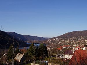
This area is found in a beautiful natural spot called the České Středohoří landscape park. It sits right next to the Elbe River, on its right side. Brná is only about 4 kilometers (about 2.5 miles) away from the main city of Ústí nad Labem. The whole area of Brná is about 4.23 square kilometers (about 1.6 square miles).
Brná has some clear natural borders. To the north, you'll find a special protected area called the Sluneční stráň nature reserve and a hill named Vysoký Ostrý. To the south, there's the Němčický stream. The Elbe River forms the western border. The eastern side isn't as clearly marked.
You can also find other hills around Brná, like Kamenný vrch, Skřivánčí vrch, and Modřín. The Průčelský stream also flows through Brná. The land in Brná goes from about 170 meters (558 feet) above sea level up to 700 meters (2,297 feet) high!
How Many People Live Here?
Brná has grown quite a bit over the years. More and more people have chosen to live in this nice area. Here's a quick look at how the number of people living in Brná has changed:
- In 1869, there were only 188 people.
- By 1900, the population had grown to 199.
- In 1930, it jumped to 464 people.
- By 1970, there were 751 residents.
- In 2001, the number reached 965.
- Most recently, in 2021, about 1,308 people called Brná home!
This shows that Brná has become a popular place to live, with its population steadily increasing over time.


