Cairo Precinct, Alexander County, Illinois facts for kids
Quick facts for kids
Cairo Precinct
|
|
|---|---|

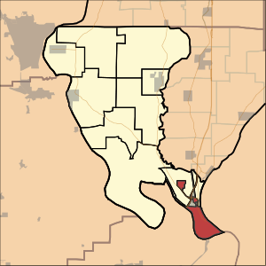
Location of Cairo Precinct in Alexander County
|
|
| Country | United States |
| State | Illinois |
| County | Alexander |
| Area | |
| • Total | 9.11 sq mi (23.6 km2) |
| • Land | 6.99 sq mi (18.1 km2) |
| • Water | 2.12 sq mi (5.5 km2) 23.28%% |
| Elevation | 315 ft (96 m) |
| Population
(2020)
|
|
| • Total | 1,733 |
| • Density | 190.23/sq mi (73.45/km2) |
| GNIS feature ID | 1928457 |
| FIPS code | 17-003-90612 |
Cairo Precinct is a special area in Alexander County, Illinois, in the United States. It's like a neighborhood or district. In 2020, about 1,733 people lived there. This precinct is exactly the same area as the city of Cairo.
Exploring Cairo Precinct's Location
Cairo Precinct covers an area of about 9.11 square miles (23.60 square kilometers). Most of this area, about 6.99 square miles (18.10 square kilometers), is land. The rest, about 2.12 square miles (5.49 square kilometers), is water.
This precinct is special because it includes the very southernmost tip of the state of Illinois. Imagine standing at the lowest point of the entire state – that's in Cairo Precinct!
Who Lives in Cairo Precinct?
In 2020, there were 1,733 people living in Cairo Precinct. There were 828 households, which are like homes where people live together.
People of different backgrounds live here. About 69% of the people were African American, and about 25% were White. A small number of people were Native American or from other racial groups. About 1% of the population identified as Hispanic or Latino.
The people living in Cairo Precinct are of different ages. About 22% were under 18 years old. About 23% were 65 years old or older. The average age of people in the precinct was around 47 years old.
See also

 | Selma Burke |
 | Pauline Powell Burns |
 | Frederick J. Brown |
 | Robert Blackburn |

