Chiautempan facts for kids
Quick facts for kids
Chiautempan, Mexico
|
||
|---|---|---|
|
City
|
||
| Chiautempan | ||
|
||
| Country | Mexico | |
| State | Tlaxcala | |
| Municipality | Santa Ana Chiautempan | |
| Founded | 1380 AD | |
| Area
(municip.)
|
||
| • Total | 66.21 km2 (25.56 sq mi) | |
| Elevation | 2,300 m (7,500 ft) | |
| Population
(2005)
|
||
| • Total | 46,776 | |
| (municip.) | ||
| Time zone | UTC-6 (Central (US Central)) | |
| • Summer (DST) | UTC-5 (Central) | |
| Postal code |
90800
|
|
| Area code(s) | 246 | |
| Demonym | Chiautempense | |
| Website | www.chiautempan.gob.mx | |
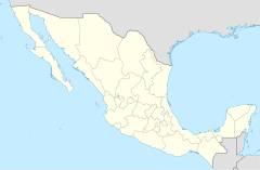
Santa Ana Chiautempan is a city in Tlaxcala, a state in Mexico. It is located in the south-central part of the state. This city is the main town of the Chiautempan Municipality.
In 2005, about 46,776 people lived in the city. This made it the fourth-largest community in the state. The entire municipality had a population of 63,300 people. The municipality covers an area of about 66.21 square kilometers (25.56 sq mi).
Contents
About Chiautempan
Where is Chiautempan Located?
Chiautempan is found in the state of Tlaxcala, Mexico. It sits high up, about 2,300 meters (7,546 feet) above sea level. This high elevation means it has a cool climate. The city is at the western edge of its municipality.
A Look at Chiautempan's History
Chiautempan has a long history. It was founded way back in 1380 AD. This means it has been a settled place for over 600 years! Over time, it has grown into the city we see today. People from Chiautempan are called "Chiautempense."
What is the Chiautempan Municipality?
The city of Santa Ana Chiautempan is the main center of the Chiautempan Municipality. A municipality is like a local government area. It includes the main city and other smaller towns nearby.
Some of the other important towns in this municipality are:
- San Bartolomé Cuahuixmatlac
- San Pedro Tlalcuapan de Nicolás Bravo
- San Pedro Muñoztla
These communities work together with the main city.
Government and Leadership
The local government of Chiautempan is led by a person called the Presidente Municipal. This is similar to a mayor in other countries. For example, Linda Marina Dolores Munive Temoltzín was the Presidente Municipal from 2005 to 2008. The local government helps manage the city and its services.
Sister Cities
A sister city is a partnership between two cities in different countries. These partnerships help people learn about other cultures. They also encourage trade and tourism.
See also
 In Spanish: Chiautempan para niños
 | Bayard Rustin |
 | Jeannette Carter |
 | Jeremiah A. Brown |


