Ciudad Bolívar, Bogotá facts for kids
Quick facts for kids
Ciudad Bolívar
|
|
|---|---|

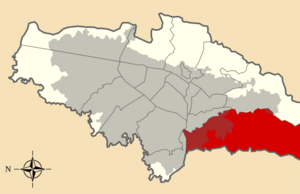
Location of the locality in the city of Bogotá
|
|

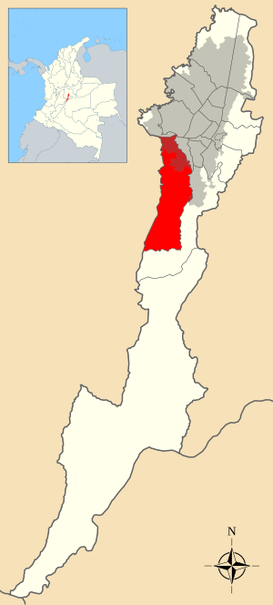
Location of the locality in the Capital District of Bogotá
|
|
| Country | Colombia |
| City | Bogotá D.C. |
| Neighbourhoods |
List
Madelena
|
| Area | |
| • Total | 130 km2 (50 sq mi) |
| Elevation | 2,600 m (8,500 ft) |
| Population
(2007)
|
|
| • Total | 593,937 |
| • Density | 4,570/km2 (11,800/sq mi) |
| Time zone | UTC-5 (Colombia Standard Time) |
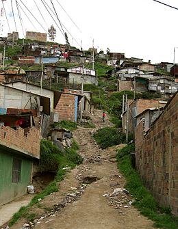
Ciudad Bolívar is a large area in the southern part of Bogotá, the capital city of Colombia. It is the 19th official locality within the city. This area is located on the southern edge of the Bogotá savanna, which is a high plain. Many people with lower incomes live here.
Most of Ciudad Bolívar is made up of mountains and countryside. However, its urban part is very large and home to many people. This urban area has a very high population density.
Contents
Exploring Ciudad Bolívar's Geography
The locality of Ciudad Bolívar is mostly mountainous, about 90% of its total area. It covers about 229.14 square kilometers. Only 20.88 square kilometers of this is urban, meaning it's where buildings and people are concentrated. This makes it the 7th largest locality in Bogotá.
Ciudad Bolívar is located in the southwest of Bogotá's urban area. It shares borders with several other areas. To the north, it borders the localities of Bosa, Kennedy, and Tunjuelito. The Tunjuelo River and the Autopista Sur highway form part of this northern border. To the west, it borders the nearby towns of Soacha, Sibaté, and Pasca. To the south, it borders the large locality of Sumapaz. Finally, to the east, it borders Tunjuelito and Usme.
Getting Around Ciudad Bolívar
There are not many major roads that go through all the neighborhoods in Ciudad Bolívar. The Avenida Ciudad de Villavicencio is an important road. It crosses the locality diagonally from north to east.
The Avenida Boyacá is another key road. It helps people get around the neighborhoods on the eastern side of Ciudad Bolívar. The Avenida Jorge Gaitán Cortés serves the neighborhoods in the southeastern part.
The TransMilenio system, which is Bogotá's rapid bus transit, also serves some parts of Ciudad Bolívar. You can find TransMilenio stops along the Caracas Avenue. These stops include Perdomo and Centro Comercial Paseo Villa del Río - Madelena.
A Look at Ciudad Bolívar's History
In the 1950s, the area that is now Ciudad Bolívar was mostly large farms called haciendas. As Bogotá grew rapidly, these farms were divided into smaller pieces. This led to the start of urbanization. The first neighborhoods to form were Meissen, San Francisco, Buenos Aires, Lucero Bajo, and La María. These areas were settled by people with lower incomes. Many of them were immigrants from other parts of Colombia, like the Tolima and Boyacá regions. By the 1970s, the population in this area had grown quickly to about 50,000 people.
A second wave of growth began in the 1980s. New settlements appeared on the higher parts of the southern hills. These included neighborhoods like Naciones Unidas, Cordillera, Alpes, Juan José Rondón, and Juan Pablo II. The Inter-American Development Bank also helped build neighborhoods for families with lower incomes. These included Sierra Morena, Arborizadora Alta, and Arborizadora Baja. These areas quickly became very populated.
In 1983, the Council of Bogotá created the Ciudad Bolívar Plan. This plan was designed to guide how the area would develop. On September 14, 1983, a local government office called the Minor City Hall of Ciudad Bolívar was established.
Colombia adopted a new constitution in 1991. This changed Bogotá's status to a Capital District. Because of this, Ciudad Bolívar became a locality with its own local government. It now has a Local City Hall and a Local Administrative Junta (Council) with 11 council members.
Neighborhoods and Rural Areas
Well-Known Neighborhoods
Some of the more recognized neighborhoods in Ciudad Bolívar include: La Estrella, El Paraíso, Lucero Alto, San Joaquín, Sierra Morena, San Francisco, Perdomo, Madelena, La Isla, Alto de La Cruz, Minuto de María, and Francisco Pizarro.
Rural Veredas
Some of the rural areas, known as veredas, in Ciudad Bolívar are El Mochuelo and Pasquilla. El Mochuelo is located near the Doña Juana Landfill, which is a large waste disposal site.
Ancient Discoveries
In 1987, scientists found fossil remains of an ancient animal called Etayoa bacatensis in Ciudad Bolívar. This discovery helps us learn about life from long ago in this region.
Famous People from Ciudad Bolívar
- Miguel Ángel Rubiano, a professional cyclist, was born in Ciudad Bolívar.
See also
 In Spanish: Ciudad Bolívar (Bogotá) para niños


