Clark's Lookout State Park facts for kids
Quick facts for kids Clark's Lookout State Park |
|
|---|---|
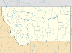
| Location | Beaverhead County, Montana, United States |
| Nearest city | Dillon, Montana |
| Area | 8 acres (3.2 ha) |
| Elevation | 4,337 ft (1,322 m) |
| Designation | Montana state park |
| Established | 1985 |
| Administrator | Montana Fish, Wildlife & Parks |
| Website | Clark's Lookout State Park |
Clark's Lookout State Park is a special place in Montana. It is located about one mile north of the town of Dillon. This small park covers 8 acres of land. It protects a hill that offers amazing views of the Beaverhead River. This spot is famous because of an important event in American history.
Contents
Clark's Lookout State Park: A Historic Viewpoint
Clark's Lookout State Park is a state park in Montana. It was created in 1985. The park is named after William Clark, a famous explorer. He visited this exact spot in 1805. The park helps us remember his journey and what he did here. It is a great place to learn about history and enjoy nature.
The Lewis and Clark Expedition's Journey
In the early 1800s, the United States was growing. President Thomas Jefferson wanted to explore the new lands. He sent Captain Meriwether Lewis and Lieutenant William Clark on a big adventure. This journey was called the Lewis and Clark Expedition. Their main goal was to find a water route to the Pacific Ocean. They also wanted to learn about the land, plants, animals, and Native American tribes.
The expedition started in 1804. It was a long and difficult trip. They traveled through many different landscapes. They faced challenges like rough terrain and unknown territories. The team included soldiers, hunters, and a guide named Sacagawea. She was a Shoshone woman who helped them a lot.
William Clark's Important Stop
On August 13, 1805, William Clark climbed this hill. He was looking for the best way forward. From the top, he could see the entire Beaverhead Valley. This view was very important for their journey.
Clark used special tools to take compass readings. He also drew a map of the valley. This map helped the expedition find their way. It showed them the path of the Beaverhead River. This river was key to finding the source of the Missouri River. Standing on this hill helped Clark understand the land. It allowed him to plan the next steps for the expedition.
Visiting the Park Today
Today, Clark's Lookout State Park is open to visitors. You can walk up the same hill that William Clark climbed. When you reach the top, you can imagine what he saw. The park has signs that explain the history of the area. These signs tell you about the expedition and Clark's visit.
It is a peaceful place for a picnic. You can enjoy the views of the Beaverhead River. It is a great way to connect with history. You can stand where an important explorer once stood. It helps you understand the challenges they faced.


