Beaverhead River facts for kids
Quick facts for kids Beaverhead |
|
|---|---|

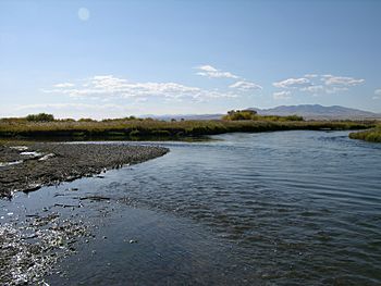
The confluence of the Beaverhead and the Ruby River, its major tributary
|
|
|
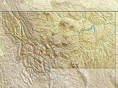
Location of the mouth within Montana
|
|
| Country | United States |
| State | Montana |
| City | Dillon & Twin Bridges |
| Physical characteristics | |
| Main source | Clark Canyon Reservoir Confluence of Red Rock River and Horse Prairie Creek 5,545 ft (1,690 m) 45°00′01″N 112°51′32″W / 45.00028°N 112.85889°W |
| River mouth | Jefferson River Near Twin Bridges, MT 4,610 ft (1,410 m) 45°34′04″N 112°20′19″W / 45.56778°N 112.33861°W |
| Length | 69 mi (111 km), Southwest-northeast |
| Basin features | |
| River system | Jefferson River |
| Basin size | 4,778 sq mi (12,370 km2) |
| Tributaries |
|
The Beaverhead River is a river about 69-mile-long (111 km) in southwest Montana. It's a branch, or tributary, of the Jefferson River. This river helps drain a large area of about 4,778 square miles (12,370 km2).
The river's natural start, where the Red Rock River and Horse Prairie Creek meet, is now covered by Clark Canyon Reservoir. This reservoir also covers the first 6 miles (9.7 km) of the Beaverhead River. From there, the Beaverhead flows north through a wide valley. It then joins the Big Hole River to form the Jefferson River. If you include the Red Rock River, the Beaverhead system is about 139 miles (224 km) long. This makes it one of the most important rivers in southwest Montana.
Contents
Why is it called Beaverhead?
The Beaverhead River gets its name from Beaverhead Rock. This is a special rock formation found along the middle part of the river. In 1805, a Native American woman named Sacagawea recognized this rock. She was guiding the Lewis and Clark Expedition through the area.
Even though there were many beavers in the area back then, the river's name doesn't come from the animal itself. A funny thing happened in 1805: Captain Meriwether Lewis went up the Jefferson and Beaverhead rivers first. He left a sign for the rest of the expedition to follow the Beaverhead. But a beaver cut down his sign! So, the expedition accidentally went up the Big Hole River instead. The Big Hole River had a much faster current, and two of their canoes got swamped before they could go back to the right path.
Part of a Big River System
The Beaverhead River, along with the Red Rock River, forms the very beginning of the huge Missouri River. The Missouri River is the longest branch of the even bigger Mississippi River. So, the water from the Beaverhead River eventually flows all the way to the Gulf of Mexico!
Fun on the River
The Beaverhead River is a "Class I water" from the Clark Canyon Dam all the way to where it joins the Jefferson River. This means it's open for people to use for fun activities like fishing and floating.
Who Helps the River?
Many groups work hard to keep the Beaverhead River and its surroundings healthy. Here are some of them:
- Beaverhead Watershed Committee: This group works to improve and fix environmental issues in the river's area. They focus on water quality, how much water is available, managing grazing lands, controlling weeds, and teaching people about the river.
- Jefferson River Watershed Council: Their goal is to work together with the community to protect and improve the natural resources, quality of life, and economy of the Jefferson River area.
- Trout Unlimited: This organization works to protect and bring back coldwater fish, like trout, and the rivers and streams where they live in North America.
- Western Watersheds Project: This group aims to protect and restore western rivers and wildlife. They do this through education, working on public policies, and sometimes through legal actions.
- Montana River Action: This group believes that Montana's clean rivers belong to everyone. Their mission is to protect and restore rivers, streams, and other water bodies in Montana.
 | Emma Amos |
 | Edward Mitchell Bannister |
 | Larry D. Alexander |
 | Ernie Barnes |


