Comalapa, Nicaragua facts for kids
Quick facts for kids
Comalapa
|
|
|---|---|
|
Municipality
|
|
| Country | |
| Department | Chontales Department |
| Area | |
| • Municipality | 249 sq mi (644 km2) |
| Population
(2005)
|
|
| • Municipality | 11,785 |
| • Density | 47.40/sq mi (18.300/km2) |
| • Urban | 1,077 |
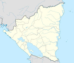
Comalapa is a municipality located in the Chontales Department of Nicaragua. It is a place where people live and work together. Think of a municipality as a local government area, like a town or a small county.
About Comalapa
Comalapa is a municipality in the country of Nicaragua. Nicaragua is a country in Central America. This area is part of the Chontales Department. A department is like a state or province in other countries.
Location and Size
Comalapa is located at specific geographic coordinates. These are 12 degrees, 17 minutes North and 85 degrees, 30 minutes West. These numbers help pinpoint its exact spot on a map. The total area of Comalapa is about 644 square kilometers. That's roughly 248 square miles. This gives you an idea of how big the municipality is.
Population
According to information from 2005, Comalapa had a population of 11,785 people. This number tells us how many people lived there at that time. Out of these, about 1,077 people lived in the main urban area. The rest lived in rural areas around the town.
What is a Municipality?
A municipality is a local government unit. It has its own leaders and rules. These leaders help manage services for the people living there. Services can include things like roads, schools, and public safety. Comalapa is one of many municipalities in Nicaragua.
See also
 In Spanish: Comalapa (Nicaragua) para niños
 | Emma Amos |
 | Edward Mitchell Bannister |
 | Larry D. Alexander |
 | Ernie Barnes |


