Cook Island, South Sandwich Islands facts for kids

South Sandwich Islands
|
|

Location of Cook Island
|
|
| Geography | |
|---|---|
| Coordinates | 59°27′S 027°10′W / 59.450°S 27.167°W |
| Archipelago | South Sandwich Islands |
| Length | 6 km (3.7 mi) |
| Width | 3 km (1.9 mi) |
| Highest elevation | 1,115 m (3,658 ft) |
| Highest point | Mount Harmer |
| Administration | |
|
United Kingdom
|
|
| Demographics | |
| Population | Uninhabited |
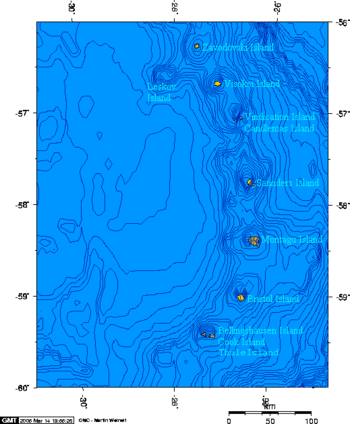
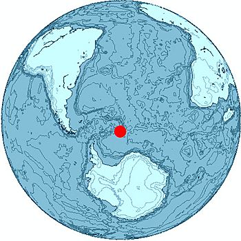
Cook Island is a remote island located in the far southern Atlantic Ocean. It is the largest island in a small group called Southern Thule. This group is part of the South Sandwich Islands. Cook Island is named after Captain James Cook, a famous British explorer.
Contents
Discovering Cook Island
Captain James Cook and his British team found the Southern Thule island group in 1775. Later, a Russian team led by Fabian Gottlieb von Bellingshausen explored the South Sandwich Islands. They named Cook Island after Captain Cook in 1819–1820.
In 1930, scientists from the Discovery Investigations (DI) explored the island. They used a ship called Discovery II. These scientists mapped the island and gave names to many of its features. More names were added later by the United Kingdom Antarctic Place-Names Committee (UK-APC).
Exploring Cook Island's Geography
Cook Island is about 6 kilometers (3.7 miles) long and 3 kilometers (1.9 miles) wide. It is covered in thick ice and snow, and no one lives there. The highest point on the island is Mount Harmer, which is 1,115 meters (3,658 feet) tall. Another peak, Mount Holdgate, rises 960 meters (3,150 feet) at the island's southeast end.
Coastal Features of Cook Island
Many points along the island's coast were named by the Discovery Investigations team or the UK-APC. Here are some of them:
- Resolution Point is on the northwest side of the island. It is named after Captain Cook's ship, HMS Resolution.
- Tilbrook Point is a noticeable cliff at the northwest tip of Cook Island. It was named for Peter J. Tilbrook, a zoologist who surveyed the islands in 1964.
- Reef Point is at the west end of the island. It has a small reef nearby, which is how it got its name.
- Jeffries Point is on the central part of the island's south side. It was named for Miss M.E. Jeffries, who helped the Discovery Committee.
- Longton Point is the southeast corner of the island. It has very tall rock cliffs and steep icefalls. It was named for Royce E. Longton, a botanist from the 1964 survey.
- Swell Point is a small, narrow point on the east coast. It is about 1.2 kilometers (0.75 miles) south of Resolution Point. Its name describes its shape.
Islands Nearby
Cook Island is located between two other islands. To its west is Thule Island, separated by a narrow passage called Douglas Strait. To its east is the tiny Bellingshausen Island, with Maurice Channel in between.
See also
 In Spanish: Isla Cook para niños
 | Bessie Coleman |
 | Spann Watson |
 | Jill E. Brown |
 | Sherman W. White |

