Dewey Square facts for kids
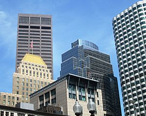
Dewey Square is a busy public space in downtown Boston, Massachusetts. It sits where several important streets meet, like Atlantic Avenue and Summer Street. Below the square, a major highway called the Central Artery (I-93) runs through the Dewey Square Tunnel. This tunnel was part of a huge construction project known as the Big Dig.
Right next to Dewey Square is South Station, a big transportation hub. From here, you can catch Amtrak trains, MBTA Commuter Rail trains, Red Line subway trains, and Silver Line buses.
The square is named after George Dewey, who was the only person in U.S. history to become an Admiral of the Navy.
History of Dewey Square
Dewey Square got its name to honor Admiral George Dewey. This happened after his big victory in the Battle of Manila Bay in 1898. Before the 1950s, when the Central Artery was built, Dewey Square was just a busy intersection. It had traffic islands and train tracks, surrounded by buildings. There wasn't any open space like there is today.
In 1898, Summer Street was made longer towards the east. A year later, in 1899, the Summer Street Bridge was built over Fort Point Channel. Also in 1899, Federal Street was closed south of Dewey Square. This made room for the new South Station. Atlantic Avenue was also extended along the west side of the new station.
Around this time, the Boston Elevated Railway changed its streetcar tracks. They created a special layout at the crossing of Summer and Atlantic. In 1901, the Atlantic Avenue Elevated train line opened. It had an elevated station called South Station, one block south of Dewey Square. This elevated line closed in 1938 and was taken down in the early 1940s.
Changes from the Central Artery and Big Dig
The next big change happened in the 1950s with the building of the Central Artery. A large area around the square was cleared. The Artery was built underground through the Dewey Square Tunnel. Atlantic Avenue became a one-way street going north. Purchase Street became one-way going south, north of the square. A new road, the Surface Artery, was built above the tunnel. It was a two-way road heading southwest from the square.
Between 1969 and 1978, Boston closed parts of Federal Street and Summer Street. They had been a one-way pair west of the square. Summer Street has since reopened as a two-way road. However, Federal Street is now a pedestrian mall, meaning only people can walk there.
The Big Dig project in the late 1990s and early 2000s kept the one-way street setups north of the square. Now, Atlantic Avenue continues as one-way (northbound) south of the square. The Surface Artery is now one-way southbound.
For a while, a temporary bus station was located just north of Dewey Square. It was built over the Central Artery. This station was used by bus companies like Peter Pan and Trailways. In 1993, all these intercity buses moved to the nearby South Station Bus Terminal. This new terminal is located just south of South Station, above the train tracks.
Dewey Square Today
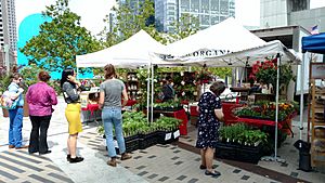
Today, Dewey Square is mostly an open plaza. It marks the southern end of the Rose Kennedy Greenway. This green space is a popular spot for people to gather. You can often find food trucks there. There is also a seasonal farmer's market run by the Boston Public Market.
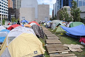
From September 30 to December 10, 2011, Dewey Square was the location of the Occupy Boston tent city.
 | Precious Adams |
 | Lauren Anderson |
 | Janet Collins |


