Hill of Beith Castle facts for kids
Quick facts for kids Hill of Beith Castle |
|
|---|---|
| Beith, North Ayrshire, Scotland GB |
|
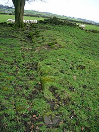
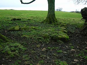
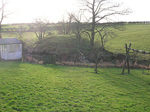
Substantial foundations of the castle tower
|
|
| Coordinates | 55°45′08″N 4°36′54″W / 55.752332°N 4.614919°W |
| Type | Tower Castle |
| Site information | |
| Owner | Private |
| Open to the public |
No |
| Condition | Foundations only |
| Site history | |
| Built | 16th Century |
| Built by | Cuninghame |
| Materials | Stone |
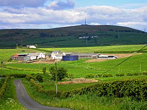
The old Hill of Beith Castle was a strong tower house located in Beith, North Ayrshire, Scotland. It was part of a large area of land called a 'Barony' that belonged to the powerful Kilwinning Abbey for many years. Today, only the foundations of this historic castle remain, giving us clues about its past.
Contents
History of Hill of Beith Castle
Monks and Farmland
Long ago, in the early 1300s, a group of monks called the Tironensian monks from Kilwinning Abbey owned a large farm here. This farm was known as a 'Grange'. Sir William de Cunninghame gave this land to the abbey. The monks were very busy with farming. Records show they produced a lot of cheese, sometimes as much as 268 cheeses in just one year!
The land around Beith was given to the Kilwinning monks in the late 1100s. As powerful landowners, the monks had the right to hold their own local court. They even had a special 'court hill' where they would decide legal cases. This old earth mound still exists near Boghall House today. The monks' main farm was probably at a nearby place called Grangehill.
The abbot, who was the head of the abbey, might have stayed at Hill of Beith Castle when he visited the area. This tower house might have been the main home on the monks' farm. Later, when the monasteries were closed down, the castle became the property of noble families. The castle stood in a great spot, with good views of the countryside. It was also naturally protected by slopes and a nearby loch called Loch Brand.
The Cuninghame Family
The abbot of Kilwinning eventually rented out the 'Lands of Hill of Beith' to a branch of the Cuninghame family. John Cuninghame, from a family connected to the Earl of Glencairn, became the new owner.
After the Reformation (a big change in religion in Scotland), James Hamilton, whose father was the last abbot of Kilwinning, took control of some of the lands. Around 1579, he sold them to Lord Robert Boyd. However, the Cuninghame family got the castle and lands back in the early 1600s. This is shown on old maps made by Timothy Pont.
Records from the 1600s show that John Cuninghame was known as 'Beith', 'Hill of Beith', or 'Gudeman of Beith'. He was also an important church elder in Beith. In 1662, John Cuninghame was fined a large amount of money (£626 13s 4d). This was because he supported certain religious groups who had caused damage to other lands.
Being called the 'Gudeman of Beith' suggests that John Cuninghame held his land from a more powerful lord, possibly Lord Boyd. A 'Gudeman' was someone who owned land but rented it from a laird (a feudal lord). It could also mean the head of a household.
The Cuninghame family sold the castle and lands of Hill of Beith by the end of the 1600s. Later, in the late 1700s and early 1800s, Hugh Brown of Broadstone Castle bought both Easter Hill of Beith and Nether Hill of Beith.
Easter and Nether Hill of Beith
The names 'Easter' and 'Nether' were used to describe two parts of the Hill of Beith area. 'Easter' means 'eastern' and 'Nether' means 'lower'. These two areas, with their homes and lands, made up the Barony of Hill of Beith. Old records from the 1600s show that the Kilwinning monastery owned them. The monks also owned Loch Brand, sometimes called Boghall Loch. People often used the shorter name 'Hill o'Beith'.
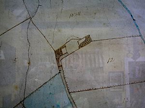
'Nether' Hill of Beith was likely a farm building located lower down, to the west. An old map from 1775 shows a farm called 'Mains' (a farm attached to a main house) with a ruined building nearby. 'Easter' Hill of Beith was also known as Overhill of Beith. This was the stronger, fortified home where the laird and his family lived. This is clear from the size of the buildings and the presence of a walled area.
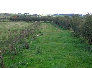
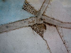
By 1832, only one farm called 'Hill of Beith' was marked on maps. The old curving path to the castle became a hedge boundary when a new, straighter entrance was built. Today, the names Easter and Nether Hill of Beith are no longer used. The name Netherhill is now used for modern buildings near the old toll house.
What Happened to Hill of Beith Castle?
Historians believe that Easter Hill of Beith was a strong, fortified building, like a tower house. It was close to the Nether or Hill of Beith Mains farm. It overlooked the monks' loch and their court hill.
In the early 1600s, the fortified home was described as "Easter-Hill of Byith, a pretty building, well planted, belonging to John Cuninghame." A map from 1654 also shows a tower house called 'Hill of Beith'.
An army map from 1747-1755 shows two groups of buildings at 'Hill of Bieth'. The eastern group was inside a wall and had one large 'L' shaped building, plus two smaller ones. This suggests it was the main fortified home.
A map from 1775 shows a building called 'Mains' with a ruined castle nearby. Although it doesn't say 'ruin', the same symbol is used for other ruined castles. By the mid-1700s, many of the castle's stones had been removed. The 1832 map no longer shows the castle site or its old entrance.
Today, you can still see parts of the castle's strong wall foundations. They are about 1.4 meters thick and 0.4 meters high, mostly covered by grass. Some parts of a nearby field wall are made of stones taken from the castle. You can even see some stones that were clearly shaped for building.
An account from 1845 says that the square castle stood near the Court Hill and was taken down in the mid-1700s. Another writer in 1925 said that 'Johnnie Cunningham's' home, the tower castle, was at Easter Hill of Beith, in the field at the top of the old grassy path.
It's possible the castle was changed into a farm dwelling before it was finally abandoned in the 1700s.
The Court Hill
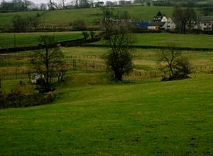
The name 'Hill of Beith' actually refers to a special mound called the 'Court Hill' or Moot hill. This rare survival of old feudal power sits near Boghall House. It's next to a small stream that flows from the old Loch Brand. The hill is made of soil and rocks. It measures about 17 paces wide at the bottom and is about 6 feet 8 inches high. The flat top is about 8 paces wide.
As powerful feudal lords, the abbots of Kilwinning Abbey and the later landowners held court on this hill. It was the main place where the legal business of the barony happened. When the monasteries were closed in the mid-1500s, the abbots stopped being involved. Sometimes, these court hills were even built with soil brought from all parts of the barony's lands.
The small group of trees next to the castle site is known locally as the 'Hangman's Wood'. This suggests that the gallows, where punishments were carried out, might have been located here.
Loch Brand or Boghall Loch
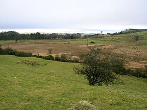
The small Loch Brand was once owned by the monks of Kilwinning Abbey. In 1482, the monks had to take legal action against some people who were accused of "dangerous destruction" of the loch's ditches and dikes. Although the loch is shown on a map from 1654, it doesn't appear on a map from 1747. It is said to have been finally drained in 1780. At that time, oak and elm stakes were found, which might have been signs of an ancient crannog (a type of artificial island dwelling) that once existed there. The land where the loch used to be is now used for farming. Even today (2010), you can see it's a bit wet and marshy.
Boghall House
Boghall House was bought by Hew Montgomerie in 1691. Over the years, it changed hands many times, with different families owning it. In 1858, William Ross JP bought it and probably built the house that stands there today. In the 20th century, the Knox family of Beith owned it.
This old house, marked as Boighall on a 1654 map, is near the site of the old loch. It was also the home of Janet Pollock, the mother of Robert Tannahill, a famous Scottish poet known as the 'Weaver Poet'.
The Mill of Beith
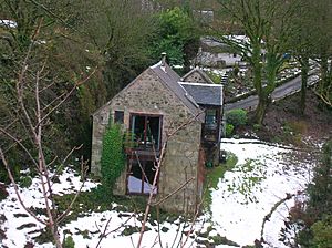
The water-mill for the Barony of Hill of Beith was located on the Muir or Roebank Burn at Mill of Beith. There's a waterfall there called the 'Warlock Linn'. The current Mill of Beith building dates from the late 1700s to early 1800s. It's a small stone building with a kiln (a type of oven). The mill wheel was about 3 feet wide and 16 feet in diameter. Water from a dam on the burn flowed through a channel to power the wheel. The ruins of the 'Davies o'the Mill', once home to Dugald Semple, are nearby.
A large rock, called a glacial erratic, sits in the Roebank Burn. In the past, local young people used it as a diving platform.
Interesting Facts
- The town of Beith was once officially known as 'Hill of Beith'. It only later got its shorter name.
- The Hill of Beith Castle site was near an old main road (turnpike) that connected Kilwinning, Beith, and Coldstream Bridge. This road was built under a law from 1767.
- 'Slim Jim' Baxter, a famous football player for Glasgow Rangers and Scotland, grew up in Hill O’Beith.
- The 'Wood of Beit', now called the 'Moor of Beith', is thought to be an Arthurian site. An old poem mentions a "battle in the wood of Beit at the close of the day."
 | Kyle Baker |
 | Joseph Yoakum |
 | Laura Wheeler Waring |
 | Henry Ossawa Tanner |


