
Horsenden Hill facts for kids


Horsenden Hill is a lovely hill and open space in West London. It sits between the areas of Perivale, Sudbury, and Greenford. This hill is in the London Borough of Ealing, very close to the border with the London Borough of Brent. It's one of the taller spots around, rising to about 85 meters (276 feet) above sea level. The very top of the hill was once home to an ancient hillfort.
Contents
How Horsenden Hill Was Formed
The bottom of Horsenden Hill is about 50 meters high. Like the land around it, the lower parts of the hill are made of a type of clay called London Clay. This clay formed about 50 million years ago.

Higher up, between 70 and 80 meters, there's a layer of sandier clay called Claygate Beds. At the very top, from 80 meters to the summit, there's a thin layer of much younger gravel called Dollis Hill Gravel. This gravel is like a protective cap. It stops the softer London Clay underneath from washing away easily. Many hills in London have a similar cap of sand or gravel. This is why they stand out from the flatter land around them.
The Ancient River and Ice Age
The Dollis Hill Gravel was left here over half a million years ago by an old river. This river flowed from Surrey in the south, heading north-east. We know this because some of the gravel is made of a special stone called chert. This stone only comes from rocks found in Surrey. This old river was probably an early version of today's River Wey.
About 450,000 years ago, during the Anglian Ice Age, a huge sheet of ice from northern Britain reached North London. This ice blocked the ancient river that had left the gravel on Horsenden Hill. A giant lake formed in front of the ice sheet. Water from this lake caused a lot of erosion. It washed away much of the Dollis Hill Gravel in the area.
This is why hills like Horsenden Hill, Barn Hill, and Dollis Hill look like islands today. They are small pieces of land that were left behind after a huge ancient lake eroded the land around them.
Horsenden Hill's History
People have lived on Horsenden Hill for a very long time. About 2,500 years ago, during the Iron Age, people settled here. We know this because lots of old pottery has been found. In 1978, the Iron Age settlement on Horsenden Hill was made a protected historical site.
The hill likely got its name during Saxon times. It was originally called "Horsingdon," with "don" meaning "hill fortress."
During the Second World War, Horsenden Hill was home to an anti-aircraft battery. This was a place with big guns used to shoot down enemy planes. These guns protected local factories from air attacks. Today, you can still see two old, unused water reservoirs built into the south side of the hill.
What You Can See and Do
The Grand Union Canal runs along the south and east sides of Horsenden Hill. It follows the land at about 30 meters (100 feet) high.
To the south-west, you'll find Perivale Wood Local Nature Reserve. This beautiful spot is managed by the Selborne Society. Horsenden Hill offers amazing views across West London and beyond. On a clear day, you can see places like Harrow on the Hill and the new Wembley Stadium. You might even spot planes landing at Heathrow Airport. You can also see parts of Surrey, Berkshire, and Buckinghamshire.
Two golf courses cover parts of the hill on the south and east sides. You can reach the hill easily from Perivale, Sudbury Town, and Greenford tube and rail stations. There's also a visitors center at Horsenden Farm on the east side of the hill. A public car park is on the north side. You can get to both from Horsenden Lane in North Greenford.
In 2006, Highland cows were brought to graze in a fenced area on the hill. This was part of the Horsenden Grazing Project. Other types of cows have grazed there since then.
Gallery
-
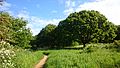
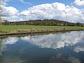
Horsenden Hill
-
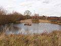
Pond
-
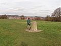
Trig point
-
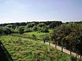
Horsenden Hill
-
Sudbury Golf Course
-
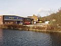
Commercial buildings by the canal at Horsenden Hill
-
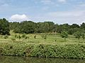
The summit of Horsenden Hill can be seen behind the rugby fields
-
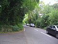
Horsenden Lane cuts through the area
.jpg)


.jpg)


