
Image: Адміністративний поділ Києва
Size of this preview: 604 × 599 pixels. Other resolutions: 242 × 240 pixels | 800 × 794 pixels.
Original image (800 × 794 pixels, file size: 96 KB, MIME type: image/gif)
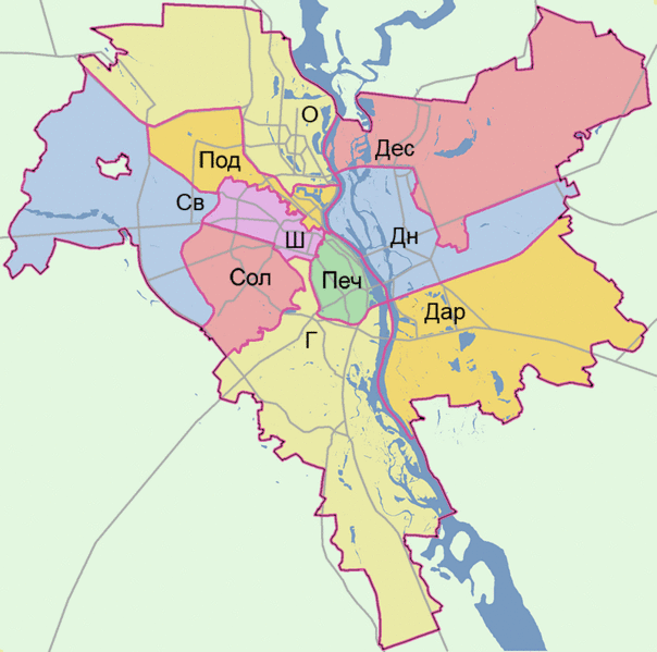
Description: Мапа районів Києва. Г — Голосіївский район Дар — Дарницький район Дес — Деснянський район Дн — Дніпровський район О — Оболонський район Печ — Печерський район Под — Подільський район Св — Святошинський район Сол — Солом'янський район Ш — Шевченківський район
Title: Адміністративний поділ Києва
Credit: Own work
Author: Artemka
Usage Terms: Public domain
License: Public domain
Attribution Required?: No
Image usage
The following page links to this image:

All content from Kiddle encyclopedia articles (including the article images and facts) can be freely used under Attribution-ShareAlike license, unless stated otherwise.