
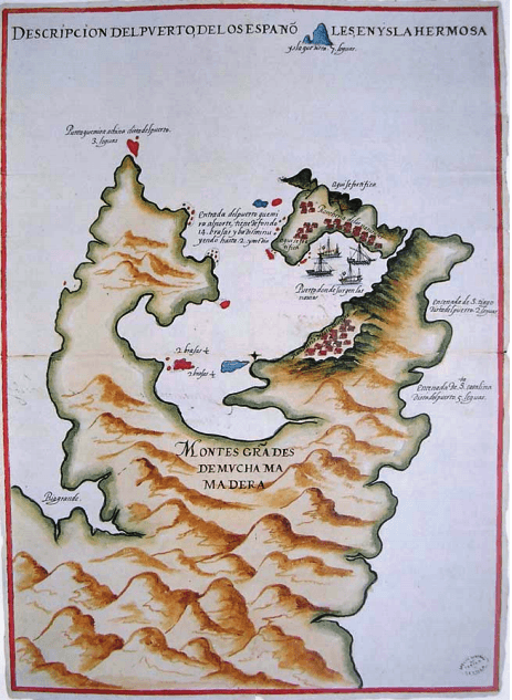
Image: 1626 Map of Keelung and Tamsui Harbor, Formosa-Taiwan by Spanish 西班牙人所繪福爾摩沙基隆港與淡水港
Size of this preview: 438 × 599 pixels. Other resolutions: 175 × 240 pixels | 463 × 633 pixels.
Original image (463 × 633 pixels, file size: 530 KB, MIME type: image/png)
Description: This maps shows the ports of Keelung and Tamsui harbor during the Spanish Formosa period (1626-1642) in Taiwan.
Title: 1626 Map of Keelung and Tamsui Harbor, Formosa-Taiwan by Spanish 西班牙人所繪福爾摩沙基隆港與淡水港
Credit: Original publication: 1626 Immediate source: http://studiesonasia.illinoisstate.edu/seriesIII/Vol%202%20No%202/3_2_1Allen_illus.pdf
Author: Unknown (Life time: d. 17th Century)
Usage Terms: Public domain
License: Public domain
Attribution Required?: No
Image usage
The following 3 pages link to this image:

All content from Kiddle encyclopedia articles (including the article images and facts) can be freely used under Attribution-ShareAlike license, unless stated otherwise.