
Image: 1811 Freycinet Map
Size of this preview: 800 × 531 pixels. Other resolutions: 320 × 212 pixels | 6,219 × 4,125 pixels.
Original image (6,219 × 4,125 pixels, file size: 3.93 MB, MIME type: image/jpeg)
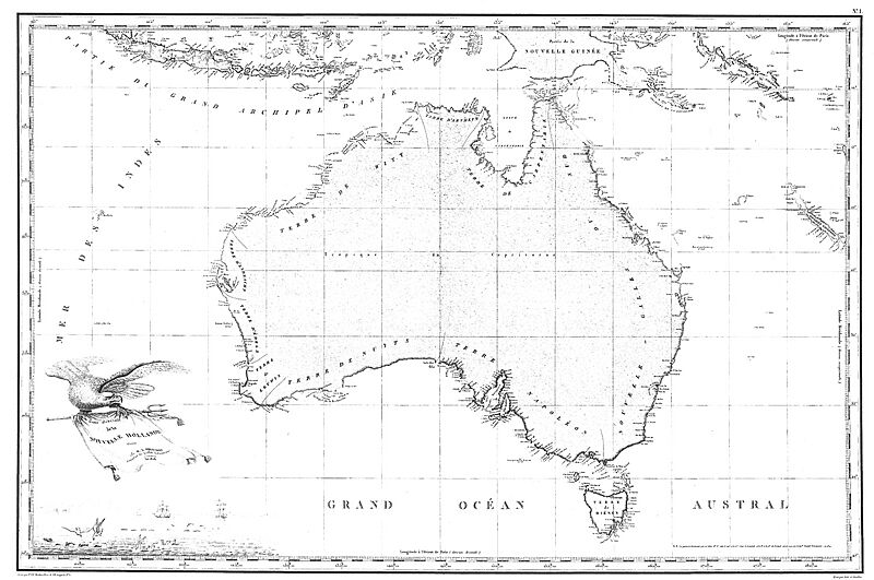
Description: The 1811 Freycinet Map - The first full map of Australia to be published.
Author: Rupert Gerritsen
Usage Terms: Creative Commons Attribution-Share Alike 3.0
License: CC-BY-SA-3.0
License Link: http://creativecommons.org/licenses/by-sa/3.0/
Attribution Required?: Yes
Image usage
The following page links to this image:

All content from Kiddle encyclopedia articles (including the article images and facts) can be freely used under Attribution-ShareAlike license, unless stated otherwise.