
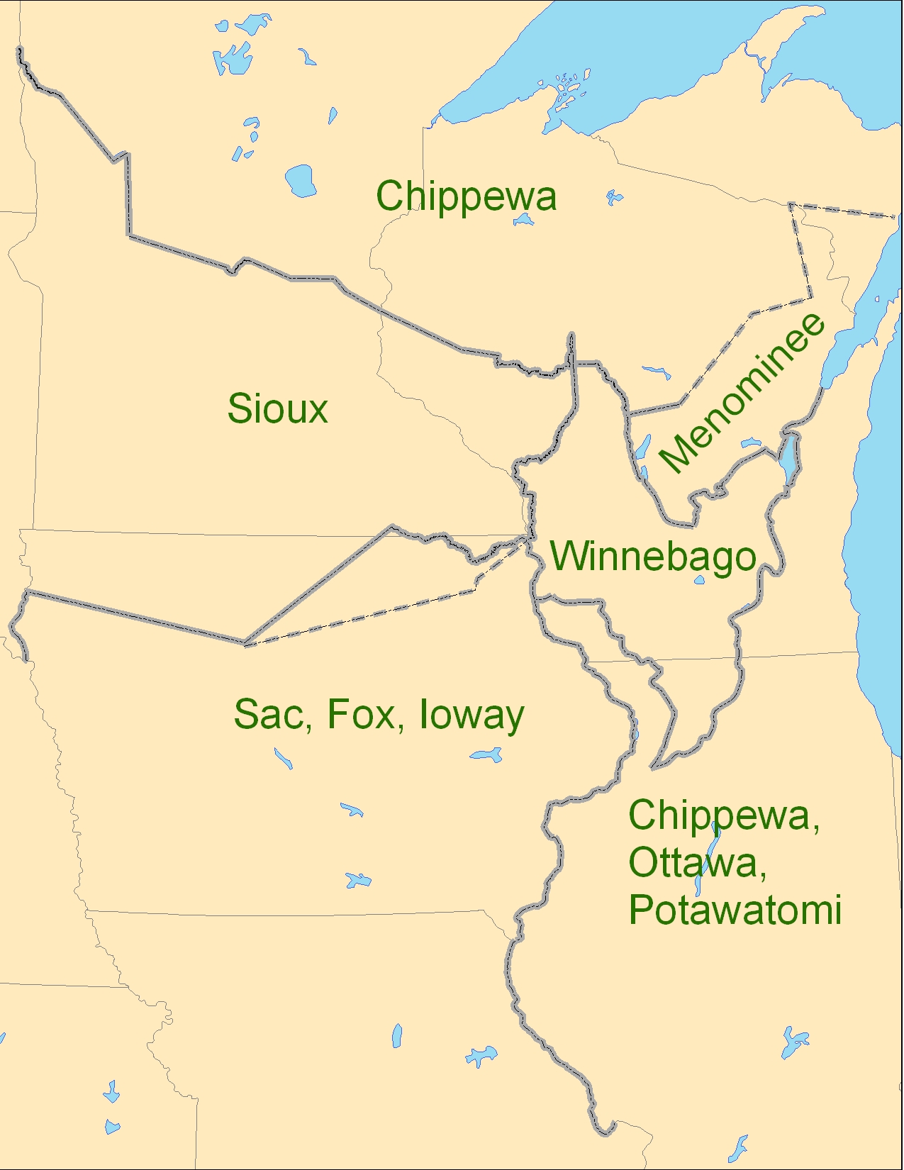
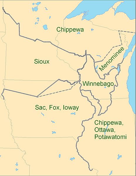
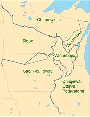
Image: 1825 Prairie du Chien Line
Size of this preview: 463 × 599 pixels. Other resolutions: 185 × 240 pixels | 1,275 × 1,650 pixels.
Original image (1,275 × 1,650 pixels, file size: 495 KB, MIME type: image/jpeg)
Description: Map showing the boundaries between the Sioux (w:Dakota), Chippewa (w:Ojibwe), Winnebago (w:Ho-chunk), Menominee (w:Menomini), Sauk and Fox (w:Sac and Fox Nation), w:Ioway, and the Chippewa-Ottawa-Potawatomi (w:Council of Three Fires) as per 1825 w:Treaty of Prairie du Chien
Title: 1825 Prairie du Chien Line
Credit: Own work
Author: CJLippert
Usage Terms: Creative Commons Attribution 3.0
License: CC BY 3.0
License Link: https://creativecommons.org/licenses/by/3.0
Attribution Required?: Yes
Image usage
The following 3 pages link to this image:

All content from Kiddle encyclopedia articles (including the article images and facts) can be freely used under Attribution-ShareAlike license, unless stated otherwise.