
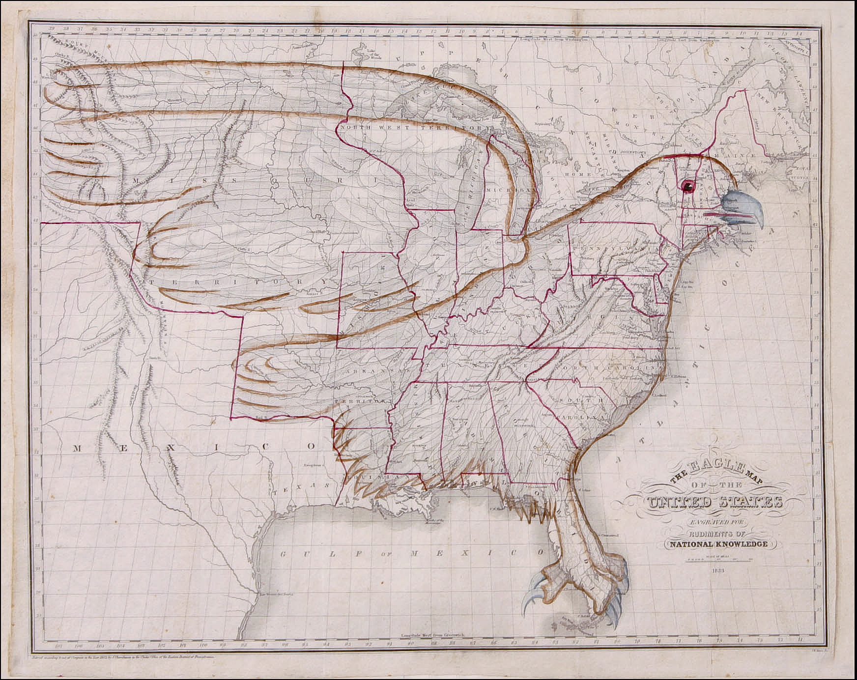
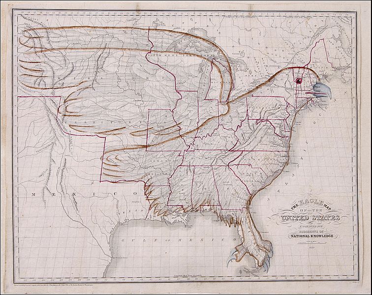
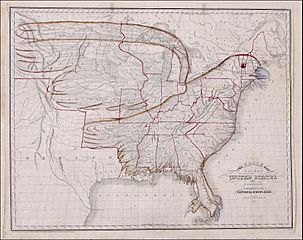
Image: 1833 Eagle Map of the U.S.
Description: Map of the territory of the United States in 1833 (ignoring the claim on Oregon) with lines added to form the shape of an Eagle. This is "The Eagle Map of the United States" from a book entitled Rudiments of National Knowledge, Presented To The Youth Of The United States, And To Enquiring Foreigners. By A Citizen Of Pennsylvania published by E.L. Carey & A. Hart in Philadelphia, 1833. A teaching wall map.
Title: 1833 Eagle Map of the U.S.
Credit: old image version: The Temporary American Eagle Exhibit at Taylor University 2008-10-31 new image version: http://bigthink.com/strange-maps/240-the-american-eagle-about-to-spread-its-wings http://www.raremaps.com/cgi-bin/gallery.pl/detail/17263 See also now http://dp.la/item/1619731699db08a2c2f8584e12729e72
Author: Joseph & James Churchman
Usage Terms: Public domain
License: Public domain
Attribution Required?: No
Image usage
The following page links to this image:
