
Image: 1835 OldSouth BostonBewickCo Boyton Boston map detail
Size of this preview: 399 × 599 pixels. Other resolutions: 160 × 240 pixels | 447 × 671 pixels.
Original image (447 × 671 pixels, file size: 491 KB, MIME type: image/png)
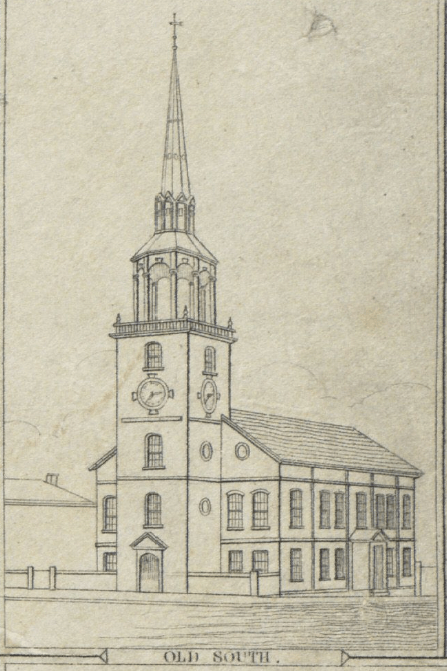
Description: Old South, Boston. Detail of 1835 map of Boston by George W. Boynton, entitled "Plan of Boston with parts of the adjacent towns." Published by the Boston Bewick Company, 1835.
Title: 1835 OldSouth BostonBewickCo Boyton Boston map detail
Credit: Boston Public Library. http://maps.bpl.org/details_10946/?dl_pp=4&mtid=5
Author: George W. Boynton
Usage Terms: Public domain
License: Public domain
Attribution Required?: No
Image usage
The following page links to this image:

All content from Kiddle encyclopedia articles (including the article images and facts) can be freely used under Attribution-ShareAlike license, unless stated otherwise.