
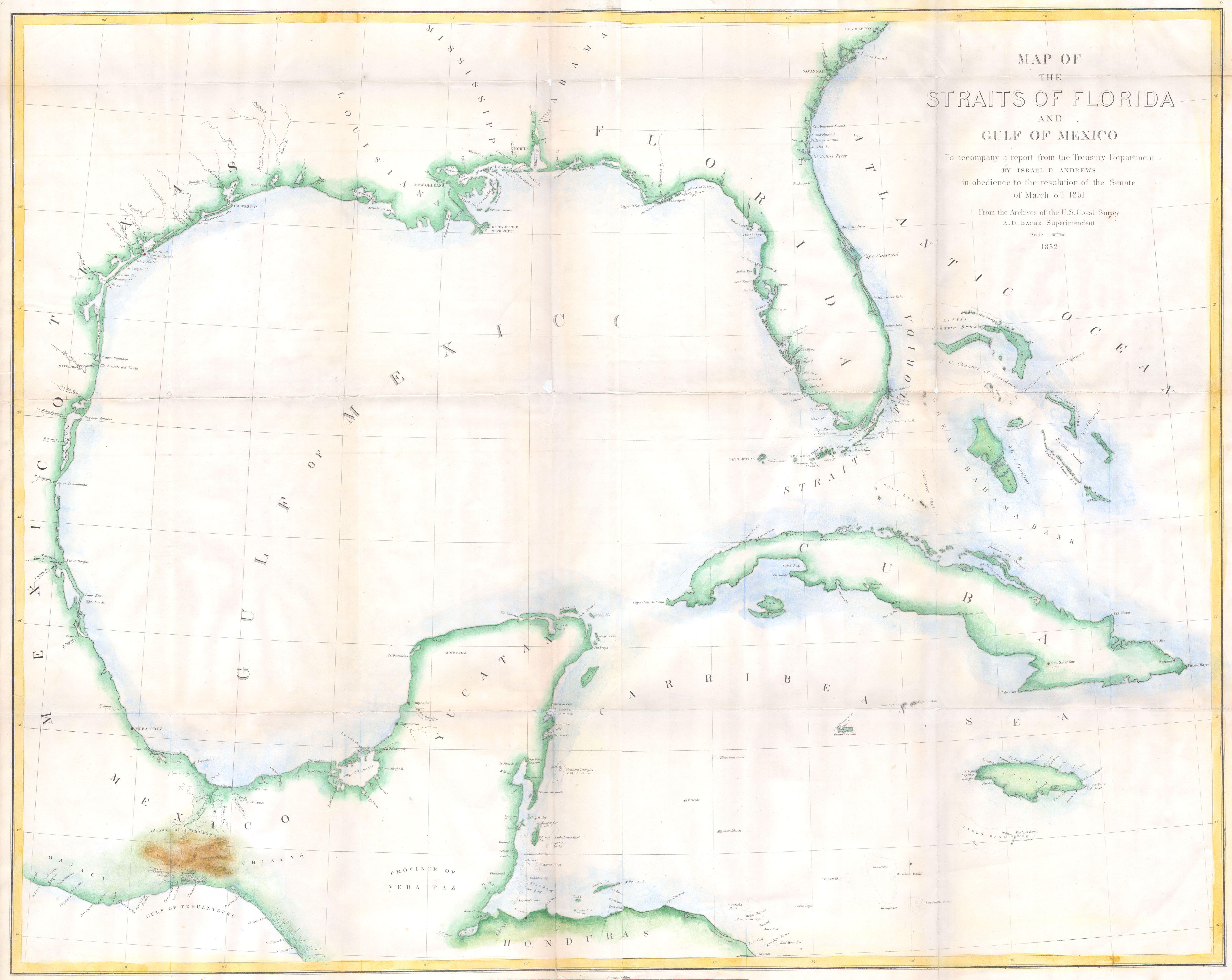
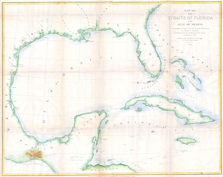
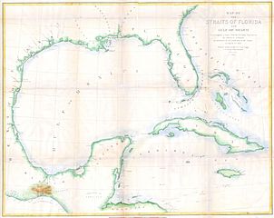
Image: 1852 Andrews Map of Florida, Cuba and the Gulf of Mexico - Geographicus - StraitsofFlorida-andrews-1852
Description: This is a rare large format costal chart depicting the full coast of the Gulf of Mexico, Florida, the Bahamas, The Isthmus of Tehuantepec, Yucatan, Cuba and Jamaica. It was issued in 1852 to accompany Israel D. Andrews’ report to the Senate. Depicts coastal cities and ports, offshore shoals, knolls, reefs, banks and other nautical hazards and some inland details, especially in the important overland crossing from Atlantic to Pacific of Tehuantepec, Mexico. Contemporary hand color. Andrews was the Consul of the United States for Canada and Trade and Commerce. U.S. Coastal Survey. Prepared under A. D. Bache. Publisher: The Office of the Coast Survey, founded in 1807 by Secretary of Commerce Albert Gallatin and President Thomas Jefferson, is the oldest organization of its kind in the U.S. Federal Government. The hard working and daring agents of the U.S. Coast Survey were the first explorers to accurately map the North American coast line, opening the ports of the west to trading vessels from Europe, America and Asia. Gallatin chose Swiss immigrant and West Point mathematics professor Ferdinand Hassler to direct the Coast Survey. Under the direction of Hassler, the Coast Survey developed a reputation for uncompromising dedication to the principles of accuracy and excellence. Hassler lead the Coast Survey until his death in 1843, at which time Alexander Dallas Bache, a great-grandson of Benjamin Franklin, took the helm. Under the leadership A. D. Bache, the Coast Survey did most of its most important work. During his Superintendence, Bache was steadfast advocate of American science and navigation and in fact founded the American Academy of Sciences. The techniques developed by the United States Coast Survey were later used by the U.S. Geological and Geodetic Survey in the late 19th and early 20th century.
Title: Map of the Straits of Florida and Gulf of Mexico. To accompany a report from the Treasury Department of Israel D. Andrews in obedience to the resolution of the Senate of March 8th, 1851.
Credit: This file was provided to Wikimedia Commons by Geographicus Rare Antique Maps, a specialist dealer in rare maps and other cartography of the 15th, 16th, 17th, 18th and 19th centuries, as part of a cooperation project. Deutsch | English | français | македонски | Nederlands | polski | +/−
Author: Creator:Israel de Wolf Andrews
Permission: This is a faithful photographic reproduction of a two-dimensional, public domain work of art. The work of art itself is in the public domain for the following reason: This work is in the public domain in its country of origin and other countries and areas where the copyright term is the author's life plus 70 years or less. You must also include a United States public domain tag to indicate why this work is in the public domain in the United States. Note that a few countries have copyright terms longer than 70 years: Mexico has 100 years, Jamaica has 95 years, Colombia has 80 years, and Guatemala and Samoa have 75 years. This image may not be in the public domain in these countries, which moreover do not implement the rule of the shorter term. Côte d'Ivoire has a general copyright term of 99 years and Honduras has 75 years, but they do implement the rule of the shorter term. Copyright may extend on works created by French who died for France in World War II (more information), Russians who served in the Eastern Front of World War II (known as the Great Patriotic War in Russia) and posthumously rehabilitated victims of Soviet repressions (more information). This file has been identified as being free of known restrictions under copyright law, including all related and neighboring rights. The official position taken by the Wikimedia Foundation is that "faithful reproductions of two-dimensional public domain works of art are public domain". This photographic reproduction is therefore also considered to be in the public domain in the United States. In other jurisdictions, re-use of this content may be restricted; see Reuse of PD-Art photographs for details. Template:PD-Art template without license parameter: please specify why the underlying work is public domain in both the source country and the United States (Usage: Template:PD-Art, where parameter #1 can be PD-old-auto, PD-old-auto-1923, PD-old-auto-1996, PD-old-100 or similar. See Commons:Multi-license copyright tags for more information.)
Usage Terms: Public domain
License: Public domain
Attribution Required?: No
Image usage
The following page links to this image:
