
Image: 1854 EastCambridgeMA map byWalling BPL 12775

Size of this preview: 754 × 599 pixels. Other resolutions: 302 × 240 pixels | 937 × 745 pixels.
Original image (937 × 745 pixels, file size: 1.18 MB, MIME type: image/png)
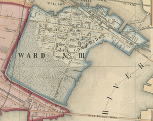
Description: Ward no.3, East Cambridge, Massachusetts, USA. Detail from: Map of the city of Cambridge, Middlesex County, Massachusetts (Cambridge MA: George L. Dix, 1854)
Title: 1854 EastCambridgeMA map byWalling BPL 12775
Credit: Boston Public Library. http://maps.bpl.org/details_12775
Author: Henry Francis Walling
Usage Terms: Public domain
License: Public domain
Attribution Required?: No
Image usage
The following 2 pages link to this image:

All content from Kiddle encyclopedia articles (including the article images and facts) can be freely used under Attribution-ShareAlike license, unless stated otherwise.