
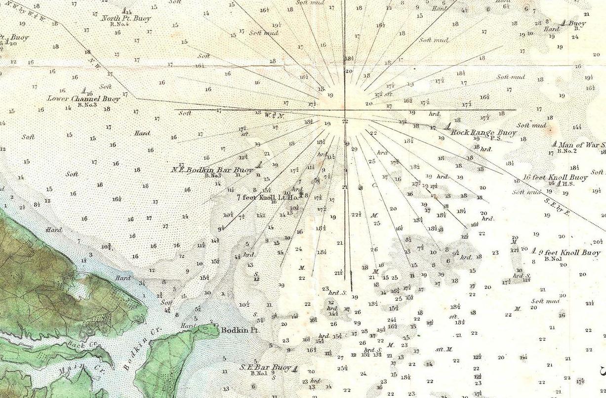
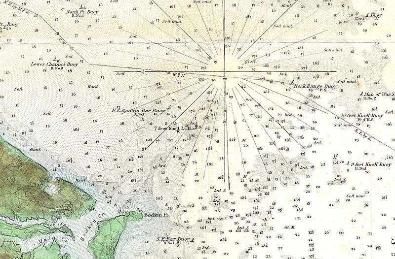
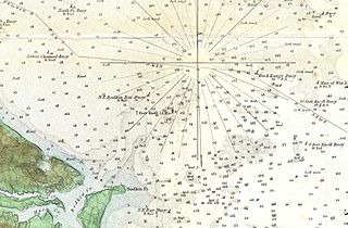
Image: 1857 U.S. Coast Survey Map or Chart of the Patapsco River, Chesapeake Bay and Baltimore - Geographicus - PatapscoRiver-uscs-1856 (cropped to Seven Foot Knoll)
Description: This is an uncommon 1856 U.S. Coast Survey Chart or Map of Patapsco River, the Chesapeake Bay, and approaches to Baltimore, Maryland. Covers from Baltimore in the northwest, eastward as far as Fairlee Creek, and southward as far as the Magothy River. Offers considerable detail throughout, but especially inland, where farms, roads, streets, and even some individual buildings are noted. Countless depth soundings throughout. Notes on tides, under sea dangers, and sailing instructions in the lower left quadrant. The Triangulation for this survey was completed by J. Ferguson. The topography is the work of F. H. Gerdes, R. D. Cutts, H. J. Whiting, and J. B Bluck. The Hydrography was accomplished by a party under the command of G. M. Bache, C. H. Mc Blair, and R. Wainwright. The construction of this chart was supervised by both A.D. Bache and F. R. Hassler, two of the most important and influential early superintendents of the U.S. Coast Survey. Published in the 1856 edition of the Superintendent's Report .
Title: Patapsco River and the Approaches.
Credit: This file was provided to Wikimedia Commons by Geographicus Rare Antique Maps, a specialist dealer in rare maps and other cartography of the 15th, 16th, 17th, 18th and 19th centuries, as part of a cooperation project.
Author: United States Coast Survey
Permission: Public domain works must be out of copyright in both the United States and in the source country of the work in order to be hosted on the Commons. If the work is not a U.S. work, the file must have an additional copyright tag indicating the copyright status in the source country. PD-1923Public domain in the United States//commons.wikimedia.org/wiki/File:1857_U.S._Coast_Survey_Map_or_Chart_of_the_Patapsco_River,_Chesapeake_Bay_and_Baltimore_-_Geographicus_-_PatapscoRiver-uscs-1856_(cropped_to_Seven_Foot_Knoll).jpg
Usage Terms: Public domain
License: Public domain
Attribution Required?: No
Image usage
The following page links to this image:

.jpg)