
Image: 1870 BackBay July4 map byFFuchs JohnWeik detail

Size of this preview: 800 × 475 pixels. Other resolutions: 320 × 190 pixels | 935 × 555 pixels.
Original image (935 × 555 pixels, file size: 990 KB, MIME type: image/png)
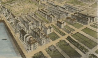
Description: Back Bay. Detail of: Map of Boston, Massachusetts, July 4, 1870. By F. Fuchs; published by John Weik.
Title: 1870 BackBay July4 map byFFuchs JohnWeik detail
Credit: Boston Public Library. http://maps.bpl.org/details_10045
Author: F. Fuchs
Usage Terms: Public domain
License: Public domain
Attribution Required?: No
Image usage
The following 2 pages link to this image:

All content from Kiddle encyclopedia articles (including the article images and facts) can be freely used under Attribution-ShareAlike license, unless stated otherwise.