
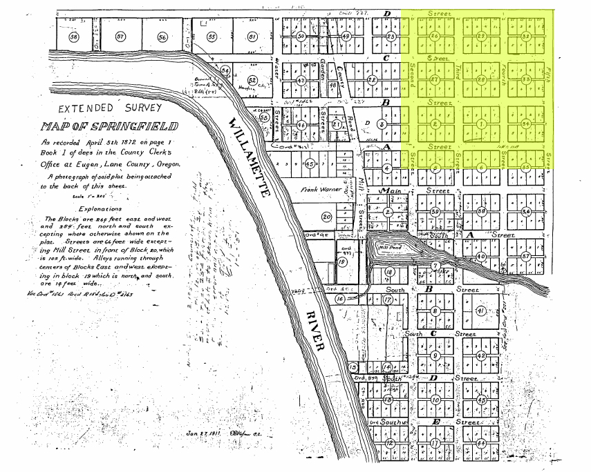
Image: 1872 map of Springfield, Oregon, showing future site of Washburne Historic District
Size of this preview: 750 × 600 pixels. Other resolutions: 300 × 240 pixels | 855 × 684 pixels.
Original image (855 × 684 pixels, file size: 445 KB, MIME type: image/jpeg)
Description: The highlighted area shows the southwest quarter of what would become the Washburne Historic District in Springfield, Oregon
Title: 1872 map of Springfield, Oregon, showing future site of Washburne Historic District
Credit: 1911 copy of an 1872 map of Springfield, Oregon, included in the NRHP nomination form data for the Washburne Historic District
Author: Office of the Lane County Clerk
Usage Terms: Public domain
License: Public domain
Attribution Required?: No
Image usage
The following page links to this image:

All content from Kiddle encyclopedia articles (including the article images and facts) can be freely used under Attribution-ShareAlike license, unless stated otherwise.