
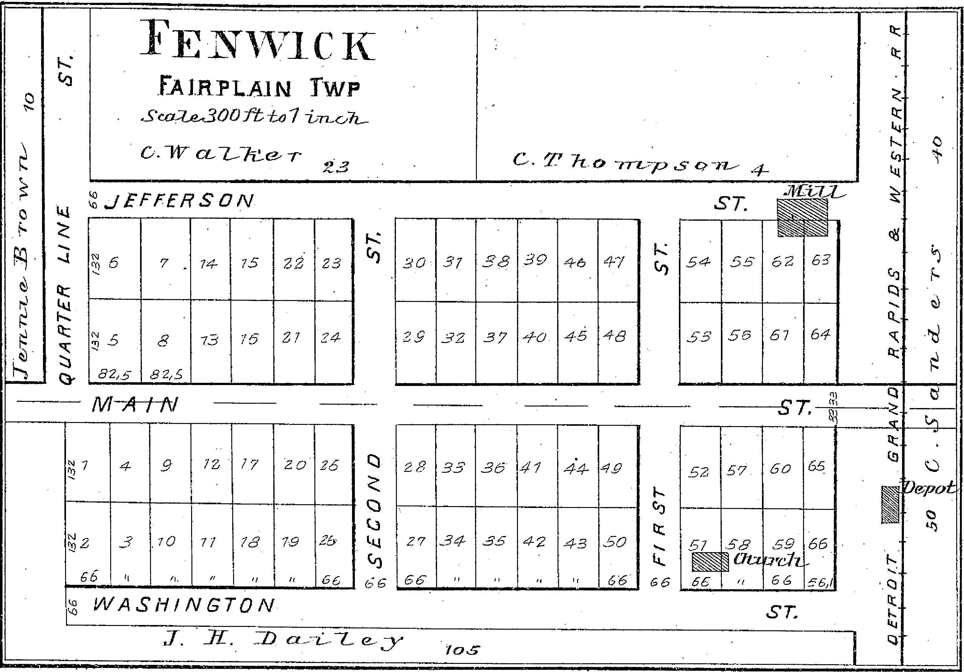
Image: 1897 cadastral map of Fenwick, Michigan
Size of this preview: 800 × 558 pixels. Other resolutions: 320 × 223 pixels | 3,097 × 2,159 pixels.
Original image (3,097 × 2,159 pixels, file size: 913 KB, MIME type: image/jpeg)
Description: Map extracted from Standard atlas of Montcalm County, Michigan (1897) published by Geo. A. Ogle & Co
Title: 1897 cadastral map of Fenwick, Michigan
Credit: https://archive.org/details/3927911.0001.001.umich.edu
Author: Geo. A. Ogle & Co
Usage Terms: Public domain
License: Public domain
Attribution Required?: No
Image usage
The following page links to this image:

All content from Kiddle encyclopedia articles (including the article images and facts) can be freely used under Attribution-ShareAlike license, unless stated otherwise.