
Image: 1922 world map
Size of this preview: 800 × 543 pixels. Other resolutions: 320 × 217 pixels | 3,495 × 2,374 pixels.
Original image (3,495 × 2,374 pixels, file size: 17.29 MB, MIME type: image/png)
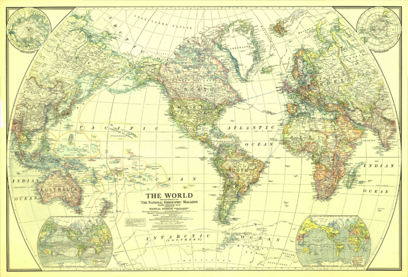
Description: Map of the World in 1922 Drawn with Van der Grinten projection. Scale on equator 1 inch = 625 miles (1 : 39,600,000)
Extra maps in the corners: North and South polar regions, natural vegetation and ocean currents, density of population and prevailing winds.
Usage Terms: Public domain
Image usage
The following page links to this image:

All content from Kiddle encyclopedia articles (including the article images and facts) can be freely used under Attribution-ShareAlike license, unless stated otherwise.