
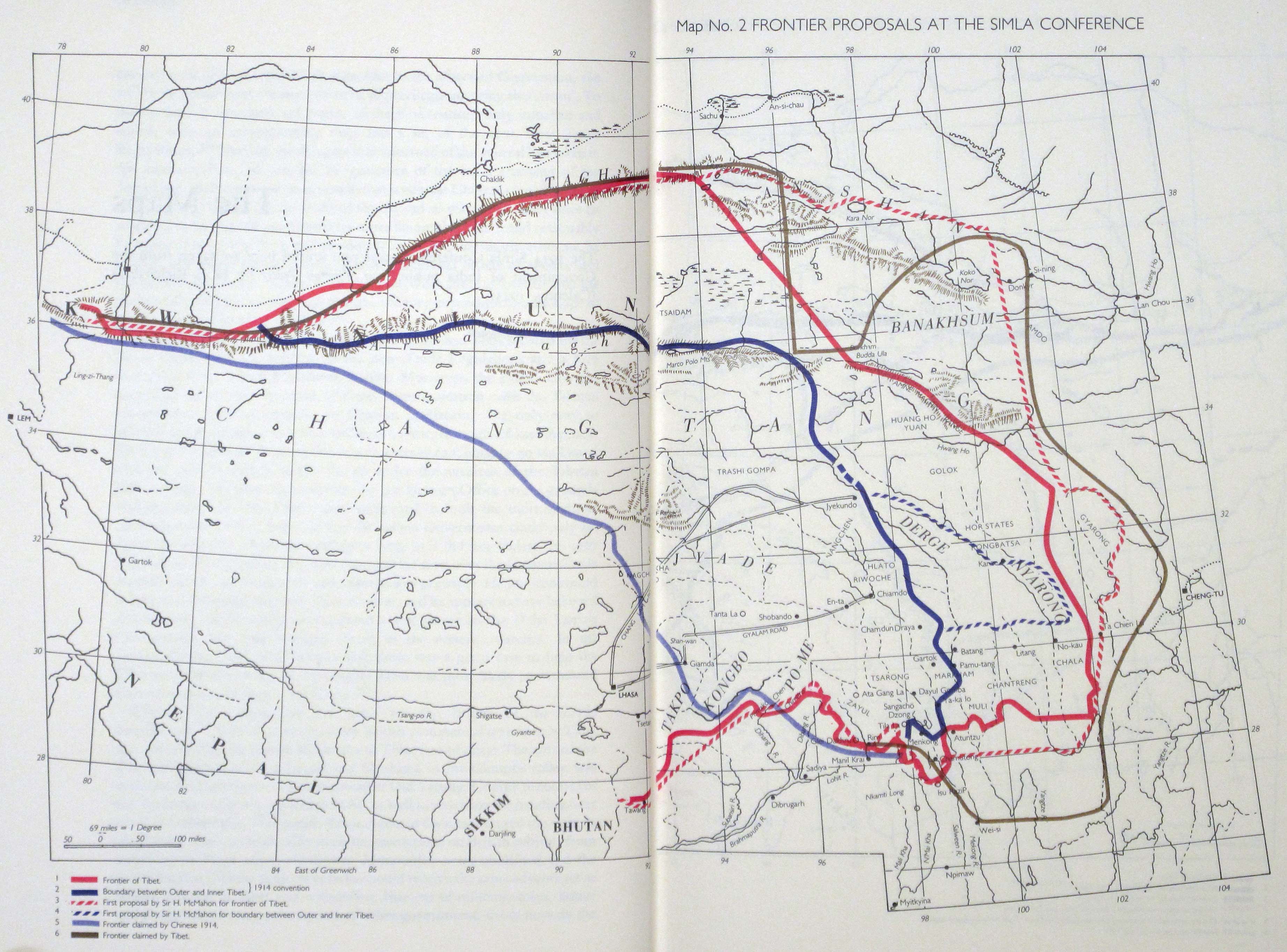
Image: 1945 Simla Conference Frontiers from Tibetan Precis by Richardson in Himalayan Triangle
Description: The map by Hugh Richardson shows the frontier between 'Inner Tibet' and 'Outer Tibet' claimed by China and that decided in the 1914 Simla Conference From the map legend: Bold red line: Frontier of Tibet Bold blue line: Boundary between Outer and inner Tibet proposed in the Simla Convention. Dashed red line: First proposal by Sir H. McMahon for frontier of Tibet. Dashed blue line: First proposal by Sir H. McMahon for boundary between Outer and Inner T'bet. Liht blue line: Frontier claimed by Chinese 1914. Dark gray line: Frontier claimed by Tibet
Title: 1945 Simla Conference Frontiers from Tibetan Precis by Richardson in Himalayan Triangle
Credit: https://pahar.in/wpfb-file/1945-simla-conference-frontiers-from-tibetan-precis-by-richardson-in-himalayan-triangle-jpg/
Author: Hugh Richardson
Usage Terms: Public domain
License: Public domain
Attribution Required?: No
Image usage
The following page links to this image:
