
All content from Kiddle encyclopedia articles (including the article images and facts) can be freely used under Attribution-ShareAlike license, unless stated otherwise.
 |
|
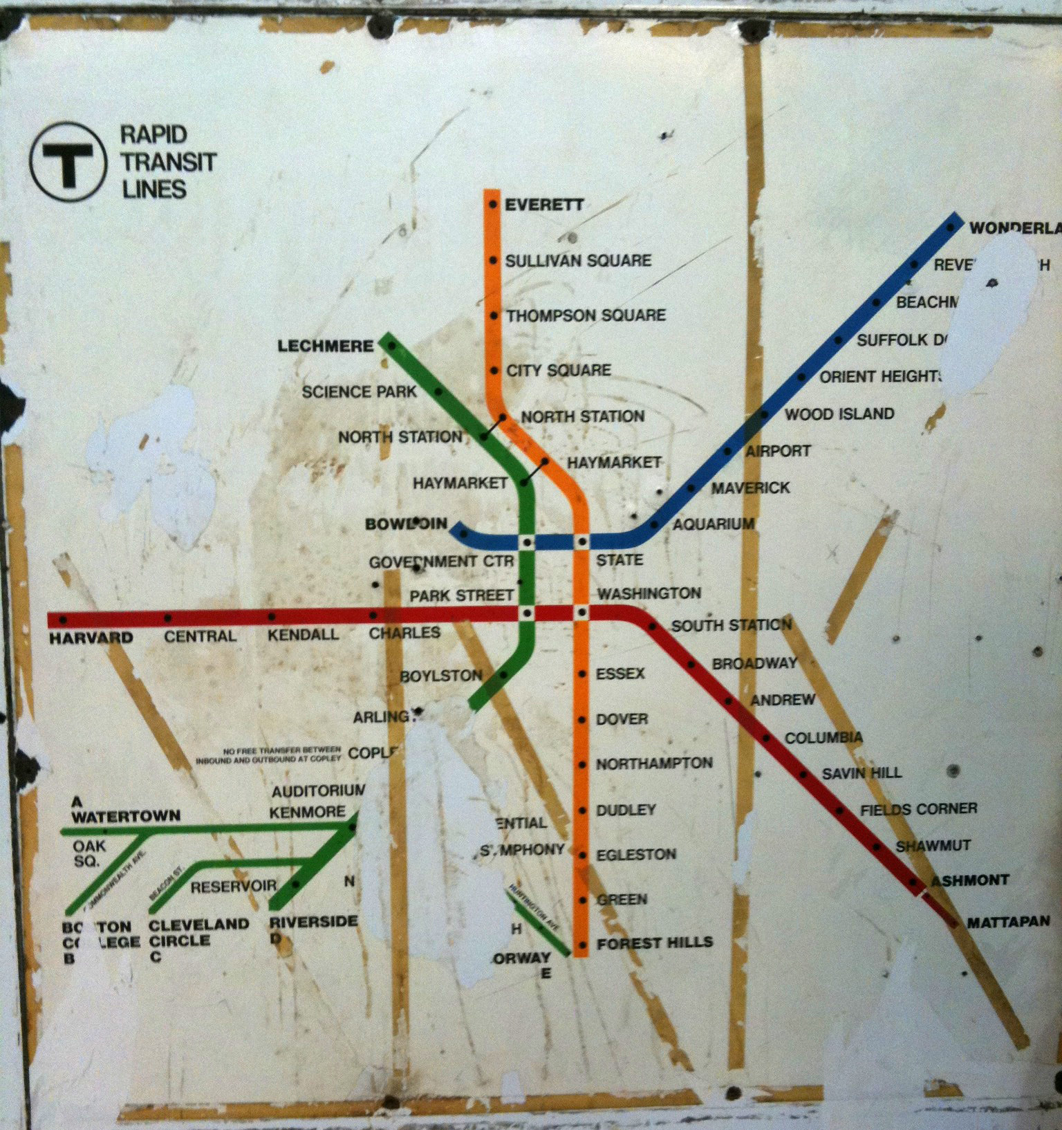
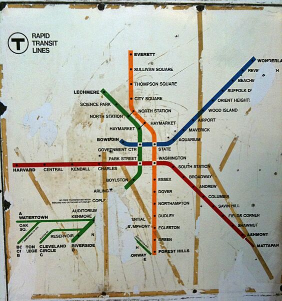
Description: Old MBTA Rapid Transit system map, reflecting network from 1967 (line colors assigned) to 1969 ("A" Branch discontinued).
Title: 1967 MBTA subway map
Credit: This map was displayed at Orient Heights station until 2012; this photograph was taken by a Wikipedia user in 2010.
Author: Map by Cambridge Seven Associates for the Massachusetts Bay Transportation Authority. Photograph taken by Angrtre at English Wikipedia.
Usage Terms: Public domain
License: Public domain
Attribution Required?: No
The following page links to this image: