
Image: 1998 Ice Storm map
Size of this preview: 800 × 412 pixels. Other resolutions: 320 × 165 pixels | 1,500 × 772 pixels.
Original image (1,500 × 772 pixels, file size: 153 KB, MIME type: image/png)
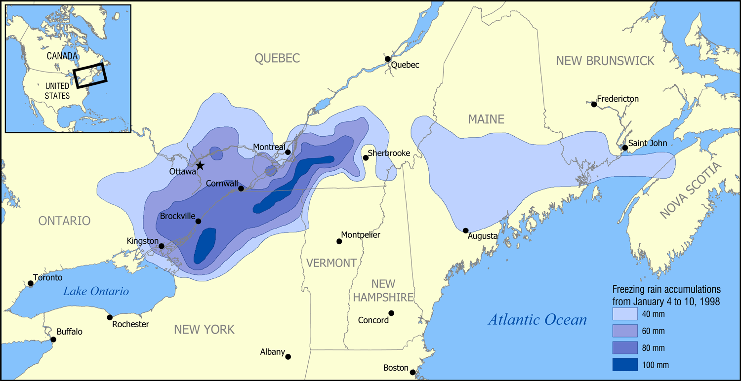
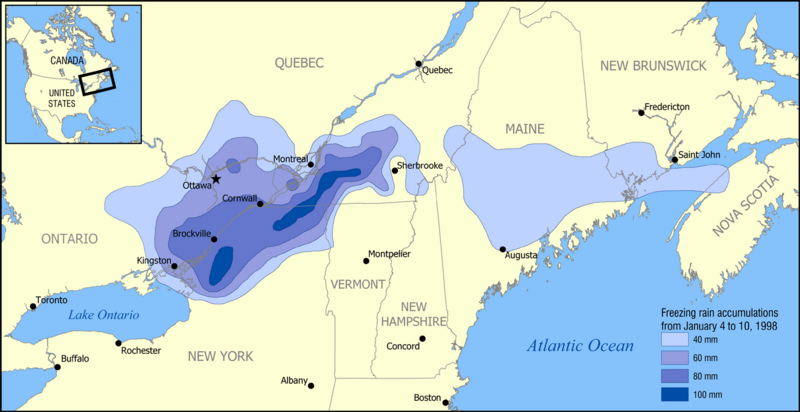
Description: A map showing the extent of the January 1998 North American ice storm that affected eastern Ontario, southwest Quebec, New Brunswick, and parts of New York, Vermont, New Hampshire, and Maine. The map shows the accumulation of ice in millimetres from January 4 to January 10, 1998. Increments shown are 40 mm (1.6 in), 60 mm (2.4 in), 80 mm (3.1 in), and 100 mm (3.9 in).
Title: 1998 Ice Storm map
Credit: Based on data from Environment Canada.
Author: NormanEinstein
Usage Terms: Creative Commons Attribution-Share Alike 3.0
License: CC BY-SA 3.0
License Link: http://creativecommons.org/licenses/by-sa/3.0/
Attribution Required?: Yes
Image usage
The following page links to this image:

All content from Kiddle encyclopedia articles (including the article images and facts) can be freely used under Attribution-ShareAlike license, unless stated otherwise.